We found 109028 price guide item(s) matching your search
There are 109028 lots that match your search criteria. Subscribe now to get instant access to the full price guide service.
Click here to subscribe- List
- Grid
-
109028 item(s)/page


Lot 36
Martyn, William Frederick "The Geographical Magazine; or A New, Copious, Compleat, and Universal System of Geography........" Harrison and Co. 1782, vol I only please note, title page in red and black type, engraved frontis, folding map of the world, folding maps, engraved plates, (not collated) rebound in full leather with original paste down title to the back strip


Lot 39
Nesbitt, E "The Phoenix and the Carpet", T Fisher Unwin Limited 1923, 6th impression, red blindstamped cloth, illustrations, worn "The Complete History of the Bastable Family", Ernest Benn, Omnibus volume printed in 1928, colour frontis and other illustrations throughout text, gilt pictorial cloth with glassine cover Masefield, John "The Midnight Folk", William Heinemann 1927, blue cloth with gilt titles, dust wrapper not price clipped, glassine cover but there are chips and loss to the edges Juster, Norton "The Phantom Toll Booth", illustrations by Jules Feiffer, Collins 1962, illustrations throughout, map ep, blue cloth, dust wrapper price clipped and some loss (4)


Lot 72
Hutchins, John, "The History and Antiquities of the County of Dorset....with a copy of The Domesday Book and Inquisitio Gheldi for the Country and adorned with a Correct Map of the County....." W. Bowyer and J. Nichols 1774, in two volumes, numerous folding plates, plans and maps (not collated at present), recased with original leather laid down on boards, the backstrip with paste down titles and raised bands, folio (2)

Lot 66
Early Motoring Interest - Stawell, Mrs Rodolph "Motor Tours in the West Country " Hodder and Stoughton 1910, " Motor Tours in Wales and the Border Counties" Hodder and Stoughton 1909, "Motor Tours in Yorkshire" Hodder and Stoughton 1909, Home, Gordon (ills.) The Motor Routes of England - Western Section Adam and Charles Black 1911, various Bartholomews county maps, "Tourist Map of Exmoor", "Bacon's Cycling and Motoring Road Map with Route Guide - 50 Miles around Derby" etc (1 box)


Lot 88
Wood, Rev J G "The Illustrated Natural History", 2 vols, reptiles, fishes, molluscs and mammalia, George Routledge & Sons 1869, frontis, plates and illustrations throughout both vols, library stamp to both title pages, some foxing, original publishers green gilt pictorial cloth Cornish, C J "Life at the Zoo", Seeley & Co 1897, photographic frontis with tissue guard, photographic plates, pictorial boards, gilt titles Three other volumes of Wood, J G "The Illustrated Natural History" Duns, Rev John "Biblical Natural Science: being the explanation of all references in holy scripture ...", vol 1 only, William Mackenzie, illustrations, plates, folding map of Asia Minor, another folding map of the Northern Hemisphere, frontis with tissue guard, ffep and frontis detached, original blindstamp and gilt titled cloth with shelfwear fading Lydekke, R "The Royal Natural History", in 5 vols, colour frontis to colour plates with tissue guards, illustrations throughout text, bkpl ffep to all vols, marbled ep, silk ribbon markers, quarter green morocco with gilt titles, green boards (12)

Lot 386
Guide Books: John Murray: A Handbook for Travellers in Japan... 1903, pocket map present; Levey, GC: The handy guide to Australasia, including New Zealand, Fiji and New Guinea. Hutchinson, (1891) Preface dated, 1st edn. Folding map, plus a loosely inserted folding map of Brisbane, 1892 (tears to folds); Bartholomew: Handy Reference Atlas of the World. John Walker, 1888; Cook's Traveller's Handbook for Palestine and Syria. 1911, pocket map present; and Aspinall: The Pocket Guide to The West Indies. 1927, covers rubbed and torn (5)

Lot 417
SCOTLAND (2 sheets): CORONELLI, VM: Scotia, parte meridonale; Scotia, parte settentionale, Venice, c.1690. Double-page engraved map of Scotland on 2 sheets extending from the Orkney Islands to the Solway Firth including the north-east coast of Ireland and part of the Isle of Man, decorative cartouches with allegorical figures, 47 x 63cm (2)


Lot 385
The THAMES, Taunt, H W: A new map of the River Thames from Oxford to London. No date, 5th. Edn. With a photographic frontis, 2 plates, a folding table, plus 33 double page maps with 101 Albumen photos. 215pp. Original brown pictorial cloth gilt, re-backed preserving most of the spine; Plus: Old Houses in Edinburgh - First and Second Series. 1905 & 1907. Each series with 27 tipped-in plates, the two series in one folder - loose, as issued, Journal of a Visit to Some Parts of Ethiopia. John Murray, 1822, 1st edn. 16 lithographic plates and plans, 2 folding engraved maps. Cont. half leather, rubbed. Damp stain to the two folding maps and one with edges frayed. Scattered spotting (3)


Lot 100
RICHARD HOLMES LAURIE, MAP ALONG WITH A HANDWRITTEN MANUSCRIPT a hand coloured folding map of Scotland, published 1828, with outer case, the manuscript with references to Lord Nelson's flagship, William Wallace, Napoleon, Queen Mary and others, signed by Daniel Caig, Helensburgh, framedthe map 84cm x 65cm open, the manuscript 26cm x 21.5cm overallQty: 2


Lot 1134
Special edition of 2500 from the Around the World Series, glossy porcelain explorer bunny with removable lid head piece, modeled on a yellow vest and green explorer hat, holding a map and a boomerang. Royal Doulton Bunnykins backstamp. Artist: S. RidgeIssued: c. 1996Dimensions: 4''L x 4.5''W x 8''HManufacturer: Royal DoultonCountry of Origin: EnglandCondition: Age related wear.


Lot 97
Kerry and its borders Misc: Kenmare Journal, 1985; large scale folding map of Kenmare; Days of the Blackthorn; Coleman, Journeys into Muskerry, c1950; signed offprint on the Derrynablaha, ‘Shield, 1971; The Diocese of Kerry, pic coves, 4to, 2005; an early Bryan MacMahon The Red Petticoat, 1955; Smith and Hickey, John B, Mercier, 8vo, h/b 2002 with real photo of John B pasted on front end paper and bio note opposite. (8)

Lot 535
New Ireland by A. M. Sullivan. Sampson Low. 1877. 2 volume set in embossed cloth. Presentation set; History of the Irish People by W. A. O’Conor. Period 1829 to 1881. Manchester. 1987 and Ireland under Elizabeth by O’Sullivan Bear, translated by Matthew J. Byrne [Listowel] old college stamp. folding map. Dublin. 1903. 4 interesting books


Lot 203
Irish Interest: A revised Catalogue of Irish Macrolepidoptera (Butterflies and Moths) by E S A Baynes 1964; The Salmon Rivers of Ireland by Augustus Grimble with Folding map, 1913; British and Irish Salmonide by Francis Day, 1887; The Sea Angler-Afloat and Ashore by Desmond Brennan with numerous illustrations, 1965 (4)Ex libris)
![The Prince of Wales Leinster Regiment [The Royal Canadians] by Colonel Whitton. an all-Irish corps raised in 1805 and later a](https://cdn.globalauctionplatform.com/552239d1-41b1-4a9e-9d86-b176011b1b2c/9d3f7ecd-1b71-41fa-ab30-b17601206103/468x382.jpg)
Lot 393
The Prince of Wales Leinster Regiment [The Royal Canadians] by Colonel Whitton. an all-Irish corps raised in 1805 and later amalgamated into the Prince of Wales becoming the 1st Battalion Leinsters in 1881. Also map volume. Schull Books. Three large format volumes in a slipcase and limited to 200 sets


Lot 42
Ireland from Sea to Sea. A practical hand-book to Galway, Connemara, Achill and the West of Ireland with a description of the principal objects of interest on the journey from Dublin. Midland Great Western Railway of Ireland. 1896. Embossed cloth. Large folding map. Fascinating advertisements


Lot 82
Connemara interest. Wilde’s Loch Coirib its Shores and Islands with notices of Loch Measga by Colm O’Lochlainn. Three Candles Press. 1955 in dj with folding map; A Look into the Past. Our Irish Heritage by John Gallagher in dj; Rambles Round Donegal by Campbell; Archaeological Heritage of Killaser, Mayo by O’Hara and Tulsk Parish its History and Folklore by Gormley. 5 book


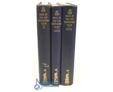
Lot 260
3x Volumes of 'The Book of The Old Edinburgh Club' with early references to golf to incl1918 Vol. X (see folding map frontis of Bruntsfield Links, and other golf on p.17-35 and 239-252) ex Public Library (G), 1932 Vol. XVIII (see golf on p.1-10 and 124-127); and 1949 Vol XXVII (see golf p.119-121, 131-136, 138-139 and 148-150) - all in matching blue and gilt decorative cloth boards and spine - all very respectable

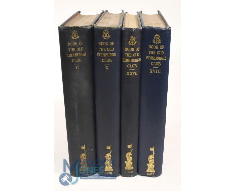
Lot 235
4x Volumes of 'The Book of The Old Edinburgh Club' with early references to golf to incl 1909 Vol. II (see p. 115-16 Golf); 1918 Vol. X (see folding Map frontis of Bruntsfield Links, and other golf on p.17-35 and 239-252), 1932 Vol. XVIII (see golf on p.1-10 and 124-127); and 1949 Vol XXVII (see golf p.119-121, 131-136, 138-139 and 148-150) - all in matching blue and gilt decorative cloth boards and spine


-
109028 item(s)/page