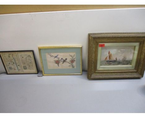
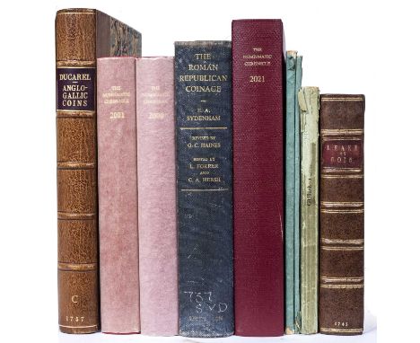
We found 118273 price guide item(s) matching your search

Refine your search

Year

Filter by Price Range
  • List
  • Grid
  • 118273 item(s)
    /page

Lot 468

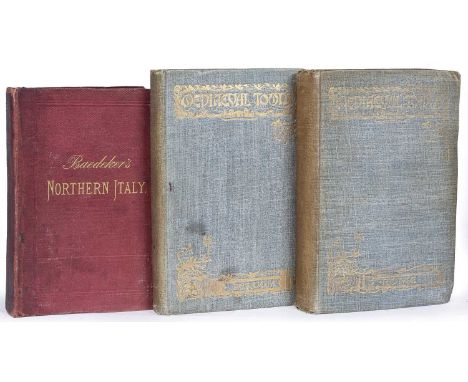
Ducarel, Andrew Coltée. English Antiquarian (1713-1785). A Series of above two hundred Anglo-Gallic or Norman or Aquitain Coins...'. With portrait frontispiece after A Soldi, London 1758 with folding map and multiple plates. 4to. with ACD bookplate (loose). Rebound with marbled boards, red title plus Martin-Leake, Stephen. 'An Historical Account of English Money...'. 2nd Ed. Meadows, London 1745. 8vo. Full calf re-backed. plus seven associated titles/catalogues etc (9)

Lot 472

Ogilby, John, Translator, Nieuhoff, Jan (1640-1672) ‘An Embassy from the East India Company of the United Provinces to the Grand Tartar Cham, Emperor of China’ 2nd Ed. 1673, Engraved frontispiece and red and black title page. Double page map. 17 engraved full page plates c100 in text, engravings, tears and repairs. Collates well except pp. 428-430 deficient and some mispagination pp. 216/220. Marbled boards. Half calf rebacked (380 x 230mm) Selbourne b/p

Lot 481

Raynal, Guillume Thomas Francois (1713-1796) 'Atlas de Toutes Les Parties Connues du Globe Terrestre...' fifty engraved maps by Rigobert Bonne (1727-1794) 18th century French cartographer, including a folding world map, plus text and index of maps, plus tables. Half calf with marbled boards and decorative end papers. Some tears, stains and mis-folding, edges bumped (254 x 200mm)

Lot 502

Fuller, Thomas, 'The Historie of the Holy Warre'. Thomas Buck. Cambridge (Printer) 1639. With engraved title page (trimmed) and a folding map. 4to. Full calf with splits and repairs (275 x 184mm)

Lot 577

Roscoe, Thomas. History and Description of the London and Birmingham Railway. Charles Tilt, London, Wrightson and Webb, Birmingham 1839. 1st Ed(?). Eighteen plates and folding map. Rebound marbled boards, half calf. 4to. (230 x 145mm) plus Osborne's Guide to the Grand Junction. Birmingham, Liverpool and Manchester, 1838 with folding map. Original cloth (160 x 100mm) both with de Spon b/ps. Used condition (2)

Lot 582

Belzoni, Giovanni Baptista (1778-1823). Narrative of the Operations and Recent Discoveries with the Pyramids, Temples, Tombs and Excavations in Egypt and Nubia. 3rd Ed. 2 vols. John Murray, London 1822 with portrait frontispiece, preface to 3rd/2nd Ed. Folding Map of the Course of the Nile reduced from Col. Leakes Map of Egypt, Vol I. and folding Plan of the Temple of Jerusalem in Vol II. 8vo. Full calf with splits/losses etc., plus Wilson, Erasmus. 'Cleopatra's Needle'. Brain & Co, London 1877. Gilt decorative red cloth. 8vo. Ex lib with stamps plus Klunzinger, C.B. 'Upper Egypt It's People and It's Products'. Blackie, London 1878. Red cloth. 8vo. In used condition with splits. All with de Spon b/ps (4)

Lot 604

A group of 19th century titles including 'The Antiquarian and Topographical Cabinet...Great Britain'. 2 vols. Murray et al, London 1817. Numerous engravings plus 'A Physician's Holiday or a month in Switzerland' with folding map. Orr & Co, London 1852 plus 'The Heimskringla' or 'The Sea Kings of Norway' by Samuel Laing. Longman, London 1844. 3 vols. plus Dickens, Charles. 'Little Dorrit'. Chapman and Hall, London n/d c1890 plus one further title. All in used condition (8)

Lot 606

Dixon, John H. Gairloch in North West Rosshire...with a guide to Gairloch and Loch Maree. With many illustrations and folding map. Cooperative Printing Co. Edinburgh 1886. 8vo. Blue cloth, edges bumped etc. plus Queen Victoria 'Leaves from the Journal of our Lives in the Highlands'. Smith Elder 1868. Contemporary owners signature plus 'More Leaves...' Smith Elder 1884. Owners signatures, green cloth. 8vo. plus four titles relating to fishing and shooting in the Highlands of Scotland (7)

Lot 660

Bertin, T.P. Trans. Le Passe-Temps De L'Enfance. Paris 1810. 3 vols. Small format. Half calf plus Mickle, William Julius. The Lusiad or the Discovery of India. Vols. I/II only of three. Harding, London 1807 with folding map and plates, full calf (loose) plus Milton, John. 'Paradise Lost and Paradise Regained'. John Sharpe, London 1816. Half calf plus one other small format title (8)

Lot 663

Baedeker, Karl. Northern Italy. Leipsic 1879 with folding map plus 'Mediaeval Towns - Rome and Perugia'. Dent 1898/1901. Blue cloth. All in used condition (3)

Lot 19

THE KING EDWARD VII FULL REIGN BRITISH EMPIRE GOLD SOVEREIGN SET,comprising nine sovereigns dated from 1902 - 1910, along with a map of the British Empire and certificates of authenticityNo Canadian mint coins included.

Lot 553

Atkyns 'Map of Gloucestershire', AD 1712 (35cm x 39.5cm), framed and glazed, together with a Cary map of Cheshire (40cm x 52cm) framed (lacking glass)

Lot 1905

Four framed decorative prints comprising 'Salute to the Many' signed limited edition monochrome print by Mandy Shepherd 166/1000, map prints of The Cotswolds and The Forest of Dean and a Michael Oxenham poultry study 208/850

Lot 1937

An antique Hogarth framed monochrome map print of Cheshire with latin text and hand coloured border lines - centre fold

Lot 1951

A framed large format coloured Great Britain & Ireland Political Map - sold with a star chart

Lot 950

DEVON The Exeter Journal and Almanack, For 1854 sm.8vo orig. fl. leather wallet, fldng. map, plus WORTH, R.N. A History of Devonshire... 1st. ed. 1886, London, lrge. paper copy, sm.4to orig. quarter L. plus Who's Who in Devonshire 1st.ed. 1934, Hereford, lrg.8vo orig. gt. dec. cl. ltd. ed. (3)

Lot 956

(CHURCHILL, W.S.) Dunkirk top Berlin: A Map... Wartime Journeys... Churchill... 1956, London, lrg. cold. fldng. map in orig. case, plus The History of the King's Works Plans vol. (1963), London, 4 plans in orig. box (2)

Lot 210

Framed ordnance survey map, featuring High Bailey Head, Grahams Unset and Lords Town

Lot 292

Box of fourteen mountaineering and climbing books, The Age of Mountaineering by James Ramsay Ullman, 1956, 1st edition with dust jacket, Mountaineering in Britain by Ronald W Clark, 1957, 1st edition, Avalanches and Snow Safety by Colin Fraser, by Peter Gilman, Frost on Everest The Search for Mallory & Irvine, La Suisse a Pied (Switzerland by foot), Souvenir of a Holiday for Young Tourists by Charles Dehansy with foldout map published in French with ten tinted plates and unfolded map published in 1961 etc

Lot 35

AN EARLY HAND COLOURED MAP AFTER WILLIAM KIP, of Staffordshire and the surrounding areas, framed and glazed, 30 x 37 cm

Lot 565

AFTER SAXTON AND HOLE. AN ANTIQUE HAND COLOURED MAP OF BUCKINGHAMSHIRE. 29 x 30cms TOGETHER WITH ANOTHER MAP OF BUCKINGHAMSHIRE AFTER OWEN BOWEN. 19 x 12cms (2)

Lot 566

AFTER R. W. SEALE. AN ANTIQUE HAND COLOURED MAP OF ENGLAND, SCOTLAND AND IRELAND. 36 x 27cms

Lot 2056

Framed, hand-tinted map of Staffordshire, 19th century

Lot 2084

Two small blacksmith/metal working irons along with hand tinted map of Derbyshire

Lot 450

Bradshaw's Railway Companion, published by Bradshaw & Blacklock, Manchester, 1841, original cloth boards, frontispiece map of London detached, also 'A Hand-Book for Travellers along The London and Birmingham Railway', c. 1839 and Bacon's Motoring and Cycling Road Map, Birmingham District. (3)

Lot 517

GERARD MERCATOR AND PETRUS KAERIUS (PIETER VAN DEN KEERE) - 'Wales' - Cambriae Typus Auctore Humfredo Lhuydo Denbigiense Cambobritanno, 17th Century hand coloured engraved map, framed, 36cm x 51cm, frame size 60cm x 75cm.

Lot 436

Daily Telegraph tourist map of Great Britain on board

Lot 142

A WWII Second World War related silk ' escape ' map of French Indo China and Siam Double sided. 1:1,000,000. Shows all main roads, canals and railways during the period. Measures approx 97x60cm.

Lot 154

A WWII Second World War Japanese map of the European Powers 1945. A large map on paper engraved by Fuchida and printed by Yokota. On paper size 110 by 79 cm. Colour. Covers Europe and European Russia, the North Atlantic, the Middle East and North Africa. With inset maps of the world and a series of panels with information on the economic and military resources of the great powers. Their relative military strength is shown in a series of graphic images of planes and soldiers etc. Measures approx 110x79cm

Lot 181

A WWII Second World War Wales Home Guard OS Map dated 1940. Pontypridd & Barry. Originally published by the Ordnance Survey Southampton 1922, then published at the War Office 1932, coded Geographical Section General Staff 3907. Scale one inch to the mile. On folding linen size 91 by 66 cm. With five stamps around the margins indicating that this was used by the 3rd battalion of the Home Guard, Bridgend. Colour. Includes Cardiff and some of Newport. Measures approx 90x65cm

Lot 238

An original Falkland War era 1982 dated Argentine steel combat helmet souvenir. The helmet dedicated to the 2nd Battalion Parachute Regiment with the units insignia to the back and ' 2nd April - 14th June 1982 The Falklands War ' along with a Falkland Island map painted with a British Union Jack flag.

Lot 384

Postcard - ' Norton Hill Pit Disaster - Scene At Pit's Mouth 10-4-1908 ' - scarce early real photographic postcard of the scene in Midsomer Norton , Somerset. Printed by WM Jones of Coleford, Bath. The card showing the scenes of the aftermath with a large crowd gathered near the pit mouth. 6x4". No folds or tears, generally excellent physical condition.  Details of the disaster can be found here: www.nmrs.org.uk/mines-map/accidents-disasters/somerset/norton-hill-colliery-explosion-midsomer-norton-1908/

Lot 68

A WWII Second World War Third Reich Nazi German ' Kuban Shield ' badge. The badge struck on sheet metal depicts the German eagle with outstretched wings clutching a Swastika above a stylized map of the Kuban region in Russia. Note; from a large private collection of militaria. Due to the nature of some items, buyers are reminded for the need to satisfy themselves as to originality / origin / condition prior to bidding, irrespective of any description. No guarantees are implied nor offered and all lots remain sold 'as is'. 

Lot 308

CHURCHMANS, Sectional Cycling Map, missing no. 50, VG, 49

Lot 2003

D-Day Interest - A Second World War Group of Four Medals to a Sergeant Peter Denton, the Royal Pioneer Corps, comprising 1939-45 Star, France and Germany Star, Defence and War Medal, together with three French medals commemorating the Normandy Landings and Operation Overlord, also portrait photographs of the recipient, his beret, cap badge, Normandy Veterans Association tie and tie clip, and a map of Cruelly pencilled in with the landing sites.

Lot 2163

A Quantity of Militaria, includind a Second World War prismatic marching compass by T.G.Co., dated 1944, a pair of Prism No.2 Mk.3 military binoculars in webbing case, various buttons, two button plates, a pair of goggles, a Canadian Army side cap, a North Africa silk escape map, cloth insignia, dog tags, a packet of Radiant wax candles etc

Lot 2179

Seven Items of Military Ephemera, comprising four Viet-cong propaganda cards, circa 1960's/70's, two French Indochine (Vietnam) maps - Yen-Luu and Cua-Thai-Binh, and a Map of the Occupation Areas of Germany 1937 to 1945 (7)

Lot 160

An 18th century strip map Lewes to Rye, a Chinese painting of birds on silk, and FFP - sailing boats, oil on board 15cm x 23cm, mounted in a glazed frame Location:

Lot 580

A framed map of Scotland, published 1783 by C Dilley and G Robinson, London; together with a later framed map of the county of Renfrewshire Condition Report:Available upon request

Lot 102

A lot of two framed prints, a framed map of Britain and Ireland and an upholstered footstool (4) Condition Report:Available upon request

Lot 1106

Retina Reflex cameras x 2 with accessories and paperwork plus a Titbits map in a vintage suitcase

Lot 285

Peter Parley: 1- book of GYMNASTICS. Lingham, no date c1840 (inscribed 1848), covers detached & lacking part of the spine; 2- Tales about the Sun, Moon & Stars. Tegg, 1837. Upper cover detached; 3- Tales about Europe. No date, with frontis; Plus: Polar Scenes, Exhibited in the Voyages of Heemskirk and Barenz to the Northern Regions. Harris, 1821, 1st. edn. With title page vignette map of the Arctic plus 36 engravings on 18 pages. PP: 138, (ii) adverts. Original leather backed printed boards; rubbed and chipped; occasional small stain. (4)

Lot 288

FARMING: VANCOUVER, C: General View of the Agriculture of the County of Cambridge. 1794, 1st. edn. In two parts. 4to. Covers detached & lacking part of the spine; lacking Map; KENT, N: General View of the Agriculture of the County of Norfolk. Norwich, 1796, 1st. edn. Folding map & 3 plates. Leather backed boards; The east Anglian handbook and agricultural annual for 1882. Norwich, 1st. edn. Original cloth, with adverts, G+. (3)Provenance: The Peter and Pat Crofts Collection

Lot 300

C35 loose MAPS OF ESSEX (18th. & 19th. Century), including: Harrison: View accurate & correct map of Essex, 1787 (Folio, hand coloured) with a tear & small loss to the blank margin; Bowen: Large hand coloured; VG: Moule: 2 copies, Hand coloured & with views; Oddy: Hand coloured, 1813; Morden: uncoloured; Etc. (Qty)

Lot 319

MAP- BLAEU: SUFFOLCIA Vernacule Suffolke. No date, c1648. Hand coloured and mounted, with Dutch text to verso. (495x370mm)

Lot 320

MAP: Ancient Durham Map, hand coloured. Ca. 1665.375 x 495mm

Lot 324

MAP- Frederick De. Wit: NOVISSIMA PRAE CETERISALIIS ACCURATISSIMA REGNORUM ANGLIAE SCOTIAE HIBERNIAE. Ca. 1690, hand coloured and laid down (560x490mm)

Lot 325

MAP- Visscher, Nicol: MAGNAE BRITANNIAE TABULA". . Highly decorative hand coloured map of the British Isles with large figurative title cartouche, three coats of arms, etc. no date, ca. 1694 (560x470mm)

Lot 326

MAP: SPEED, John: Cambridgshire described with the devision of the hundreds, the townes situation with the Armes of the Colleges of that famous Universiti ... 1610, hand coloured with inset town plan of Cambridge, the margins decorated with heraldic shields, (520x380mm), mounted.

Lot 327

MAP: SPEED, John: Anglesey, antiently called Mona described, hand coloured.405 x 535mm

Lot 333

MAP- HENNET, G. BINGLEY, James (Engr): A Map Of The County Palatine Of Lancaster Divided Into Hundreds And Parishes From An Accurate Survey Made In The Years 1828 & 1829. Teesdale, May 1, 1830. Hand coloured and with an inset view, (1600x1150mm). Linen backed and folding, with the original leather box.

Lot 341

Emanuel Eichel (1717-1782), After August Scheller'Tobias Conrad Lotter, Statua Regum Europaeorum P.C.N. Nomina Continens'hand coloured copper engraving64 x 51cm, unframed;together with R Greeves, After James Pollard'London Fire Engines'mezzotint52 x 73cm, unframed;and three other prints, largest 48.5 x 62.5cm, unframed (5)Condition ReportAll unframed and in varying conditions. Eichel print has fold along centre, time stained and some light foxing, has tears on edges and holes from old fixing along top and bottom margins, plate itself is generally fine. Greeves is time stained and has foxing, damage in margins, a couple of repaired tears, please see images. View of Constantinople has folds, tears, time staining, tear at centre repaired verso. 'La galere reale' print has fold down centre, time staining, foxing. Map of England - folds throughout, some creases, time staining. Please see images or contact department for additional information.

Lot 378

After John Ogilby,17th/18th century, 'The Continuation of the Road from London to Barwick', engraved and hand coloured road map, framed,33 x 45.5cmCondition ReportSome visible creases, marks and slight foxing. Frames with some knocks and marks. Not inspected out of the frame.

Lot 378A

A George III embroidered map sampler of Europe,by Jane Baron, dated 1784, each nation outlined in polychrome threads,48 x 45cm, framed and glazedCondition ReportSome small losses to threads. Small threadbare areas and repairs.

Lot 327

Belgian "Het Bierland" (Beer Country) 1982 Poster, displays the labels of some 300 beers. Below that is a map of Belgium, with numbers that refer to beers next to it. The list was compiled by Antoine Denooze and Monique Van Liefferinge and is an excellent piece of graphic design. 98cm's x 70cm's. Ex Zacron Studio

Lot 474

Map of the County of Buckingham from an actual survey made in the years 1832 & 1833. A beautifully engraved, elegant map of Buckinghamshire by the brothers Christopher and James Greenwood. The map scale of 1 inch representing 3 miles allows for tremendous detail, including churches, castles, railways, heaths, turnpike roads, woods and rivers. A delightful vignette of Stowe House adorns the lower left corner. There is also an explanation table, compass rose and a numbered reference table to the various county "Hundreds". This map was published in the "Atlas of The Counties of England". Size: 645 x 810 mm. Buyer collects or arranges courier

Lot 497

Assorted old vintage street maps and town guides including: Geographia Visitors Guide to London, 1930 London Street Guide, Cox's Cave Cheddar (Twelve Camera Snaps), Amsterdam, Coloured Map Isle of Wight Bartholomew's, Fire Service Drill Book, Bacon's Motor Road Map England & Wales

Lot 516

George & Elizabeth's Coronation May 12th 1937 Coronation Route Map with the compliments of OXO Ltd London

Lot 523

Framed maps including, a print of an old map of the Isle of Wight in a gold frame, brown mount. A framed old map of Norfolk with Norfolk history on the back and a double sided (two visible maps) framed old Road Maps; Bristol to Weymouth and Cambridge to Coventry. VGC Buyer collects or arranges courier

Lot 134

Dardanelles 1915 Photographic postcard, a map of British and French Forces HMS Bacchante

Loading...Loading...
  • 118273 item(s)
    /page

Recently Viewed Lots