We found 117902 price guide item(s) matching your search

Refine your search

Year

Filter by Price Range
  • List
  • Grid
  • 117902 item(s)
    /page

Lot 2024

Giancarlo Fisichella rare pair of black and yellow Puma race shoes, size 41.5, shoe code 2289, dated July -7 2003, both with original labels, these are only one of two pairs produced by Puma, to commemorate his first win at Brazil in 2003, the heel of each shoe embroidered with map of the Interlagos Circuit 

Lot 522

* ALFRED WAINWRIGHT MBE (BRITISH 1907 - 1991), GEAL CHÀRN ink on paper, signed and titled in the mountmounted, framed and under glassimage size 12cm x 20cm, overall size 27cm x 32cm Note: Alfred Wainwright wrote his Pictorial Guides to the Lakeland Fells between 1952 and 1966. The simple line drawings and clear concise directions make the seven pocket sized guides almost as essential as good walking boots. Wainwright died in 1991. He is remembered with a memorial in the church at Buttermere. Wainwright was born into poverty in the Lancashire town of Blackburn in 1907. The son of a stonemason, he left school when he was 13 and became an office boy in Blackburn Borough Engineer's Department. At the age of 23 he managed a holiday away from home, to the Lake District. It was love at first sight. In his book Fellwanderer Wainwright described his first visit there. "I was utterly enslaved by all I saw," he said. "Here were no huge factories, but mountains; no stagnant canals, but sparkling crystal-clear rivers; no cinder paths, but beckoning tracks that clamber through bracken and heather to the silent fastnesses of the hills. That week changed my life." He qualified as an accountant and moved to Kendal in 1941, rising to become Borough Treasurer seven years later. He spent every spare moment walking the fells that he loved so deeply. The first Pictorial Guide to the Lakeland Fells was published in 1955 and in his introduction he wrote: 'This book is one man's way of expressing his devotion to Lakeland's friendly hills. It was conceived, and is born, after many years of inarticulate worshipping at their shrines. It is, in very truth, a love-letter.' He spent 13 years compiling the seven Pictorial Guides to the Lakeland Fells, tramping the fells in all weathers at weekends, with raincoat, map and camera. Most of his fine, individual drawings were taken from his photographs. The Pictorial Guides were and are still distinctive. Fearing that printers would misspell words, his handwritten work was reproduced directly on to the page; the Westmorland Gazette of Kendal published them all. Wainwright also devised, during 1970-1, the Coast-to-Coast Walk which starts at St Bees Head on the Cumbrian coast and ends at Robin Hood's Bay on the North Sea. This is perhaps the most popular of all long-distance walks. The inaugural meeting of 'The Wainwright Society' was held on November 9th 2002 at Ambleside Youth Hostel. Numerous sketchbooks and volumes of drawings followed but in 1984 his writing took a dramatic turn. He agreed to write a book for the London publishers, Michael Joseph, which was illustrated with photographs by Derry Brabbs. Fellwalking with Wainwright became a bestseller overnight and was followed by a further seven illustrated books. Two of the books, Wainwright in Scotland and Wainwright's Coast-to-Coast Walk were accompanied by BBC2 television programmes and suddenly the reclusive walker became a virtual 'national treasure'.

Lot 519

* ALFRED WAINWRIGHT MBE (BRITISH 1907 - 1991), BASE BROWN ink on paper, signed and titled in the mountmounted, framed and under glassimage size 15cm x 20cm, overall size 29cm x 32cm Note: Alfred Wainwright wrote his Pictorial Guides to the Lakeland Fells between 1952 and 1966. The simple line drawings and clear concise directions make the seven pocket sized guides almost as essential as good walking boots. Wainwright died in 1991. He is remembered with a memorial in the church at Buttermere. Wainwright was born into poverty in the Lancashire town of Blackburn in 1907. The son of a stonemason, he left school when he was 13 and became an office boy in Blackburn Borough Engineer's Department. At the age of 23 he managed a holiday away from home, to the Lake District. It was love at first sight. In his book Fellwanderer Wainwright described his first visit there. "I was utterly enslaved by all I saw," he said. "Here were no huge factories, but mountains; no stagnant canals, but sparkling crystal-clear rivers; no cinder paths, but beckoning tracks that clamber through bracken and heather to the silent fastnesses of the hills. That week changed my life." He qualified as an accountant and moved to Kendal in 1941, rising to become Borough Treasurer seven years later. He spent every spare moment walking the fells that he loved so deeply. The first Pictorial Guide to the Lakeland Fells was published in 1955 and in his introduction he wrote: 'This book is one man's way of expressing his devotion to Lakeland's friendly hills. It was conceived, and is born, after many years of inarticulate worshipping at their shrines. It is, in very truth, a love-letter.' He spent 13 years compiling the seven Pictorial Guides to the Lakeland Fells, tramping the fells in all weathers at weekends, with raincoat, map and camera. Most of his fine, individual drawings were taken from his photographs. The Pictorial Guides were and are still distinctive. Fearing that printers would misspell words, his handwritten work was reproduced directly on to the page; the Westmorland Gazette of Kendal published them all. Wainwright also devised, during 1970-1, the Coast-to-Coast Walk which starts at St Bees Head on the Cumbrian coast and ends at Robin Hood's Bay on the North Sea. This is perhaps the most popular of all long-distance walks. The inaugural meeting of 'The Wainwright Society' was held on November 9th 2002 at Ambleside Youth Hostel. Numerous sketchbooks and volumes of drawings followed but in 1984 his writing took a dramatic turn. He agreed to write a book for the London publishers, Michael Joseph, which was illustrated with photographs by Derry Brabbs. Fellwalking with Wainwright became a bestseller overnight and was followed by a further seven illustrated books. Two of the books, Wainwright in Scotland and Wainwright's Coast-to-Coast Walk were accompanied by BBC2 television programmes and suddenly the reclusive walker became a virtual 'national treasure'.

Lot 515

* ALFRED WAINWRIGHT MBE (BRITISH 1907 - 1991), SCOUT SCAR ink on paper, signed and titled in the mountmounted, framed and under glassimage size 13cm x 20cm, overall size 26cm x 32cmNote: Alfred Wainwright wrote his Pictorial Guides to the Lakeland Fells between 1952 and 1966. The simple line drawings and clear concise directions make the seven pocket sized guides almost as essential as good walking boots. Wainwright died in 1991. He is remembered with a memorial in the church at Buttermere. Wainwright was born into poverty in the Lancashire town of Blackburn in 1907. The son of a stonemason, he left school when he was 13 and became an office boy in Blackburn Borough Engineer's Department. At the age of 23 he managed a holiday away from home, to the Lake District. It was love at first sight. In his book Fellwanderer Wainwright described his first visit there. "I was utterly enslaved by all I saw," he said. "Here were no huge factories, but mountains; no stagnant canals, but sparkling crystal-clear rivers; no cinder paths, but beckoning tracks that clamber through bracken and heather to the silent fastnesses of the hills. That week changed my life." He qualified as an accountant and moved to Kendal in 1941, rising to become Borough Treasurer seven years later. He spent every spare moment walking the fells that he loved so deeply. The first Pictorial Guide to the Lakeland Fells was published in 1955 and in his introduction he wrote: 'This book is one man's way of expressing his devotion to Lakeland's friendly hills. It was conceived, and is born, after many years of inarticulate worshipping at their shrines. It is, in very truth, a love-letter.' He spent 13 years compiling the seven Pictorial Guides to the Lakeland Fells, tramping the fells in all weathers at weekends, with raincoat, map and camera. Most of his fine, individual drawings were taken from his photographs. The Pictorial Guides were and are still distinctive. Fearing that printers would misspell words, his handwritten work was reproduced directly on to the page; the Westmorland Gazette of Kendal published them all. Wainwright also devised, during 1970-1, the Coast-to-Coast Walk which starts at St Bees Head on the Cumbrian coast and ends at Robin Hood's Bay on the North Sea. This is perhaps the most popular of all long-distance walks. The inaugural meeting of 'The Wainwright Society' was held on November 9th 2002 at Ambleside Youth Hostel. Numerous sketchbooks and volumes of drawings followed but in 1984 his writing took a dramatic turn. He agreed to write a book for the London publishers, Michael Joseph, which was illustrated with photographs by Derry Brabbs. Fellwalking with Wainwright became a bestseller overnight and was followed by a further seven illustrated books. Two of the books, Wainwright in Scotland and Wainwright's Coast-to-Coast Walk were accompanied by BBC2 television programmes and suddenly the reclusive walker became a virtual 'national treasure'.

Lot 643

MAP OF NORTH WALES, CIRCA 1793 published by J Cary, Londonmounted, framed and under glass image size 21cm x 26cm, overall size 39cm x 44cm Note: this lot is offered without reserve

Lot 177

World.- Hondius (Jodocus) Freti Magellanici ac novi Freti vulgo Le Maire exactissima delineatio, map of the Maggelan Straits, from 'Atlas Novus', engraving with hand-colouring, platemark 385 x 495 mm (15 1/8 x 19 1/2 in), good margins, central vertical fold with associated creases, some light toning and surface dirt, unframed, [circa 1640]; together with two other maps by Jansson, 'Ager Parisiensis Vulgo L'Isle De France' and 'Nieuwe Caerte waerinne vertoont wordt de gantsche Vaert van Amsterdam over de Watten...', engravings with hand-colouring, each sheet approx. 480 x 570 mm (18 7/8 x 22 1/2 in), minor toning, unframed, [c. 1640] (3) 

Lot 70

America.- Culin (Stewart) China in America: a study in the Social Life of the Chinese in the Eastern Cities of the United States, folding map frontispiece, publisher's printed label pasted to title, light spotting, original printed stiff paper wrappers, rubbed and worn, 8vo, Philadelphia, 1887.

Lot 23

Beckford (William).- Polo (Marco) The Travels..., translated by William Marsden, large paper copy, folding engraved map, bound without half-title or errata/advertisement leaf at end, William Beckford's copy with his pencil number "W.2093" to corner of front free endpaper, bookplates of D.C.F. Moodie and Henry Sidney, contemporary half red morocco, ?by Charles Lewis, spine gilt in compartments, g.e., rubbed, spine a little faded and worn at foot, 4to (303 x 240mm.), for the Author, 1818. *** The first Marsden edition of Marco Polo's 13th century travels across Asia which were originally published in German in 1477. This edition was preceded in English only by John Frampton's rare translation of 1579.Provenance: William Beckford (1760-1844), novelist, writer and collector, whose library passed to his son-in-law, the 10th Duke of Hamilton, and was sold in the great Hamilton Palace sales of 1882-83. 

Lot 189

Poetry.- Conder (Thomas, ?bookseller and map engraver, 1746/7-1831) A Collection of Peices from Different Authors, manuscript signed, title and 54pp. (on rectos only], slightly browned, original vellum, soiled and yellowed, 160 x 103mm., 1765. *** Inscribed on front pastedown: "Thos. Conder bound this Book, & began to fill it, A.D. 1765." Numerous authors, including: Alexander Pope, Olding, James Hervey, Philip Doddridge, Isaac Watts etc.

Lot 179

England & Wales.- Hole (William) Englalond Anglia Anglo Saxonum Heptarchia, engraved map with hand-colouring, sheet 300 x 395 mm (11 3/4 x 15 1/2 in), small margins, handling creases, slightly weak impression, unframed, [circa 1635]; together with a Saxton Kip map of Surrey, and a Vue d'optique of Westminster Abbey, with early hand-colouring, sheet 275 x 410 mm (10 3/4 x 16 1/8 in), repaired tear, some surface dirt and browning, unframed, [17th to late 18th century] (3)

Lot 17

Beckford (William).- Rutter (John) Delineations of Fonthill and its Abbey, first edition, large paper copy, half-title, hand-coloured aquatint frontispiece, additional pictorial title and plate, 10 other uncoloured engraved plates including unnumbered plate of South West View (as usual), large folding lithographed map hand-coloured in outline, wood-engraved vignettes, folding sheet of genealogical tables, with list of subscribers at end (not found in all copies), map torn and repaired at fold, marginal foxing to uncoloured plates, otherwise an excellent clean copy, Frances Mary Richardson Currer's copy with her bookplate, contemporary half green morocco, spine titled and ruled in gilt, t.e.g., others uncut, rubbed, spine faded, [Abbey, Scenery 418], large 4to (350 x 290mm.), Shaftesbury, by the Author, 1823.*** The best contemporary publication on William Beckford's extravagant Gothic mansion at Fonthill, built for him by James Wyatt between 1796 and 1812. The construction was rushed and the huge tower collapsed several times. Beckford was forced to sell the property and most of its contents in 1822 due to financial constraints and the majority of the building was demolished in 1825.Frances Mary Richardson Currer (1785-1861), heiress and book-collector, described by De Ricci as "England's earliest female bibliophile" (De Ricci, p.141). Currer was born at Eshton Hall, near Gargrave, in Yorkshire, her mother, a niece of Clive of India, being the only surviving child and heir of Matthew Wilson of Eshton Hall. Dibdin considered her "the head of all female collectors in Europe" and that her "library was, in its day, surpassed only by those of Earl Spencer, the Duke of Devonshire, and the Duke of Buckingham" (Reminiscences). After her death Currer's half-brother sold most of the library at Sotheby's in 1862, where it fetched nearly £6,000; and a second tranche in 1916 raised more than £3,700.

Lot 45

Homer. The Iliad, translated by Alexander Pope, 6 vol., engraved portrait, folding map and plates, some folding, contemporary calf, worn, covers detached, for Henry Lintot, 1756; Opera, 3 vol., foxing, contemporary calf, spines gilt, Leipzig, 1824 § Harwood (Rev. Thomas) Grecian Antiquities, some spotting, contemporary cloth, uncut, roan label, spine faded, 1801 § Hall (H.R.) The Oldest Civilization of Greece: Studies of the Mycenaean Age, plates & illustrations, ex-library copy with stamp to title, original cloth, gilt, spine faded, 1901, rubbed; and 9 others, 8vo & 4to (22)

Lot 163

Asia.- Shippard (William Henry, Captain, Army officer in the 29th Regiment, friend of George Catlin, 1803-65) Shippard's manuscript map of the Middle East, Indian Sub-Continent, and East Asia, with extensive annotations in the surrounding margins, detailing important events and Ancient Kingdoms within the region, pen and ink, watercolour, traces of pencil, on wove paper without watermark, laid onto linen, sheet 485 x 560 mm (19 x 22 in), ink stains and damp-stains, notably to the lower lettered margin, some old tears repaired, slightly rough edges, heavy surface dirt in places, unframed, [mid 19th century]; together with nine folders of extensive manuscript information on the region, and elsewhere, separated into geographic location, all loose, [mid 19th century] (Sm. qty.)Provenance:Captain William Henry Shippard; then by descent to the present owners*** A unique and unusual map of the region, having formed part of the Shippard's great unfinished project, the "Museum of Mankind", with extensive archive of supplementary manuscript notes.The museum, which Shippard went to great lengths to plan and establish was "intended to illustrate the History of Man by means of popular Lectures, aided and enforced by Scenery, Maps, Costumes, &c., adding every scenic attraction to the higher views of Instruction, and combining Art, History, Travels, and Geography."

Lot 160

Africa.- Tully (Richard) Narrative of a Ten Years' Residence at Tripoli in Africa, second edition, frontispiece, map, and 6 plates, most hand-coloured, library stamp of King's Inn Library, Dublin on title verso and final page, occasional light offsetting or spotting, contemporary calf, rebacked and recornered with red morocco spine label, large 4to, [Abbey, Travel 301; Tooley 493], for Henry Colburn, 1817. *** The plates mainly depict customs, antiquities, and the manners & architecture of the region. The work is ostensibly a collection of letters written by Miss Tully, sister-in-law of Richard Tully, British Consul in Tripoli; it is arguably one of the most valuable sources of information on Tripoli and the region of the early 19th century.

Lot 165

Germany.- Panoramas.- Lehnhardt (J.) Der Rhein von seiner Mündung bis Schaffhausen, folding hand-coloured lithographed strip map with town plans and landmark buildings to sides, c.1215 x 225mm., slight creasing and fraying to edges at beginning, with accompanying text booklet 'The Rhine its borders and environs...', Mainz, D.Kapp, 1851 § Delkeskamp (Friedrich Wilhelm) Atlas pittoresque du Rhin depuis Bâle jusqu'à la Mer, folding engraved strip map with views and landmarks to sides, c.285 x 2195mm., one fold repaired, text booklet mounted on inside front board (detached), Frankfurt, 1844 § Grueber (Bernhard) Donaupanorama von Linz bis Wien, folding engraved strip map with numerous vignettes at sides, by H.Winkles after Gruber, c.365 x 2600mm., tear to one fold, Regensburg, G.J.Manz, [c.1860] § Karta öfver Segelleden från Stockholm Kanalvägen till Götheborg, 4 engraved views and hand-coloured strip map of the canal within border of smaller views, c.230 x 2365mm, with text booklet by Wilhlem Malm loosely inserted, Stockholm, R.A.Huldberg, n.d., some light foxing or browning, all folding concertina-style into original boards, most cloth-backed, rubbed & soiled, the third with modern label to foot of spine; and 2 others, similar, v.s. (6) 

Lot 16

Beckford William).- Rutter (John) Delineations of Fonthill and its Abbey, first edition, half-title, hand-coloured aquatint frontispiece, additional pictorial title and plate, 10 other uncoloured engraved plates including unnumbered plate of South West View (as usual), large folding lithographed map, wood-engraved vignettes, genealogical tables and list of subscribers at end, some foxing but mostly to tissue guards, with tipped-in printed slip advertising Fonthill sale catalogues marked with buyers' names & prices available from the author, original printed boards, uncut, rubbed and slightly stained, corners worn, rebacked preserving original label, [Abbey, Scenery 418], Shaftesbury, by the Author, 1823 § Hamilton Palace Libraries (The). [Sale Catalogue] Catalogue of the First [- Fourth] Portion of the Beckford Library, 4 parts in 1 vol., with printed lists of prices and buyers' names bound at end of each part (lacking that to part 3 and with 2 leaves of part 2 list misbound after title to part 3), later half calf, spine gilt, uncut, most original upper wrappers bound in (some frayed and chipped, one torn & defective and laid down), rubbed, Sotheby, Wilkinson & Hodge, 1882-83, 4to & 8vo (2)

Lot 102

India.- Dunsterville (F.) Illustrated Guide to the Madras Railway, first edition, 40 plates, plate-guards, one map, faint spotting, cracked hinges, original pictorial cloth, rubbed and worn, splitting to joints but holding firm, staining to lower cover, oblong 4to, Madras, Higginbotham and Co, 1898.

Lot 221

Nottinghamshire.- Thoroton (Robert) The Antiquities of Nottinghamshire, first edition, initial imprimatur f. (loose & slightly frayed, ?possibly from another copy), title in red and black, 15 engraved plates, plans and map only (of 16) by Wenceslas Hollar after R. Hall, some double-page or folding, 1 plate with small marginal chip, engraved illustrations, some full-page, 8pp. and a slip of coats-of-arms at end, contemporary calf, rebacked, but retaining original backstrip, some wear to spine head and joints starting, 'Wing T1063], folio, by Robert White for Henry Mortlock, 1677.*** Provenance: Right Honourable Francis North, Baron of Guildford 1703 & Lord Rolle, Baron of Stevenstone [engraved bookplates to title verso and pastedown].

Lot 271

Mineralogy.- Mawe (John) The Mineralogy of Derbyshire: with a description of the most interesting mines ..., engraved frontispiece and 2 plates, engraved map, scattered spotting, bookplate, tear to front free endpaper with neat repair, contemporary calf-backed boards, rebacked, rubbed, bumping to corners and extremities, 1802.

Lot 133

Middle East.- Moore (Benjamin Burges) From Moscow to the Persian Gulf, first edition, frontispiece, plates, folding map at end, cracked hinges, contemporary boards, loss to joints and spine extremities but holding firm, rubbed, 8vo, 1915.

Lot 27

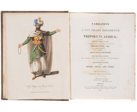
Bible, Syriac. Novum Testamentum Syriace..., Syriac half-title with Latin title on verso, printed slip at end, presentation copy from the editor, light offsetting, ex-library copy with old ink stamps to title, original boards, worn, upper cover detached, [Darlow & Moule 8979], 1816; Vetus Testamentum Syriace, Syriac and Latin titles, errata leaf mounted on rear paste-down, some spotting, contemporary embossed calf, by Watkin with his ticket, worn, covers detached, [Darlow & Moule 8981], 1823 § Bible, Ethiopic. Novum Testamentum...Aethiopice, Latin and Ethiopic titles, printed in red & black, some foxing, contemporary embossed green calf, by Burn & Sons, rubbed, spine faded and worn at ends, [Darlow & Moule 3576], 1830 § Noris (Henry, Cardinal) Annus et epochae Syromacedonum, engraved portrait and additional title with map, title in red & black with woodcut device, folding engraved table, browned, Chatsworth copy with shelf-label, contemporary calf, rubbed, rebacked with gilt spine, upper cover detached, Leipzig, T.Fritsch, 1696 Simonides (Constantine) Fac-similes of certain portions of the Gospel of St.Matthew..., lithographed frontispiece, plates, original printed wrappers, broken & loose, 1862; and c.20 others, biblical texts and commentaries, linguistics etc., v.s. (c.25)*** The final item was published by Simonides, a notorious forger, who claimed to have discovered the papyri in a private collection.

Lot 69

Africa.- Stanley (Henry Morton) In Darkest Africa, 2 vol., first edition, frontispieces, plates and illustrations, 3 maps only (of 4), of which 2 folding, one with tear and tape repair verso, previous owner's signature to front pastedown, vol. 1 lacking front free endpaper, scattered faint spotting, original pictorial cloth, bumping to corners and spine extremities, rubbed, 1890 § Cornwallis Harris (Captain William) The Wild Sports of Southern Africa, third edition, hand-coloured lithograph frontispiece, additional hand-coloured lithograph title, hand-coloured lithographs, one folding map, stain to title, occasional faint spotting, contemporary half-calf, rubbed, bumping to corners and extremities, 1841 § Dun (Major T. I.) From Cairo to Siwa, bookplate inscribed by author, plates and illustrations, original calf-backed pictorial boards, rubbed and worn, bumping to corners and extremities, Cairo, n.d.; and others on Africa, some defective, v.s. (c.60)

Lot 180

Isle of Wight.- Ordnance Survey Office. Isle of Wight, from the Geological Survey of England and Wales, engraved map with hand-colouring, sheet 540 x 1050 mm (21 1/4 x 41 1/4 in), dissected and mounted on linen, folding into cloth slipcase with printed label to upper cover, 8vo, [circa 1800]; together with C. Smith's 'A New Map of Hampshire', showing the Isle of Wight, engraving with hand-colouring, sheet 530 x 480 mm (20 3/4 x 18 7/8 in), dissected and mounted on linen, some off-setting and browning, folding without slipcase, 8vo, 1832 (2)

Lot 182

London.- Collins (Henry George) New Plan of London from Actual Survey, engraved map with some hand-colouring, sheet 295 x 460 mm (11 1/2 x 18 in), mounted on linen, folding into boards, printed label to upper cover, very worn, 8vo, [circa 1850]; together with two variant Tape Indicator Map of London, one published by Smith & Son, the other E.J. Larby, both with tapes present, folding into original boards, 8vo, circa 1910s (3)

Lot 25

Beckford (William).- Hoskins (G.A.) Travels in Ethiopia, above the Second Cataract of the Nile, first edition, folding engraved map, 54 lithographed plates on 53 sheets (one printed on both sides), 2 hand-coloured and 4 chromolithographed, several folding and/or double-page, wood-engraved illustrations, tissue guards, map lightly foxed and torn at central fold, William Beckford's copy with his pencil number "W.29" to corner of front free endpaper, bookplate of Henry J.B.Clements, contemporary half diced russia, gilt, by J.Mackenzie, spine titled in gilt within double fillet and with Beckford's cinquefoil ornament, a little rubbed, spine faded, joints cracked, [Blackmer 832; Shapero, Africana 186], 4to, 1835.*** Hoskins "was the first to describe and illustrate the antiquities of Meroe and was one of the few Europeans to have ventured beyond the second cataract at that time." (Shapero, Africana). The four chromolithographed plates, printed by Hullmandel and dated April 1835, are reputed to be the earliest English examples to be published.Provenance: William Beckford (1760-1844), novelist, writer and collector, whose library passed to his son-in-law, the 10th Duke of Hamilton, and was sold in the great Hamilton Palace sales of 1882-83. Many of Beckford's books were bound with a gilt cinquefoil from his mother's Hamilton arms on the spine or corners.Hamilton Palace sale (1882) Part II lot 928; Clements library sale (1966) lot 151. 

Lot 305

Badovici (Jean) “Harmonies" Interieurs de Ruhlmann, 40 plates, 16 with pochoir colouring, some heightened with gold or silver, occasional foxing, loose as issued in original cloth-backed board portfolio with ties, text leaves unopened, rubbed and soiled, Paris, [1924] § Shiraishi (Fumio, editor) Kabuki: A Set of 6 Pictures...by Gekko Ohashi, Series I, 6 colour woodblocks printed by Shinagawa, loose as issued with explanatory booklet in original board portfolio with ties, illustrated title to upper cover, Kyoto, Hanga, 1954 § Gautier (Theophile) Mademoiselle de Maupin, one of 500 copies, engraved plates by John Buckland Wright, original vellum-backed cloth, slight staining to lower outer corners, Golden Cockerel Press, 1938 § Sayers (Dorothy L. ) Gaudy Night, first edition, first issue with "ver" for "very" on p.157 line 22, rear free endpaper torn and repaired, original cloth, a little stained, spine slightly frayed at head, 1935 § Davidson (Lionel) The Rose of Tibet, first edition, original boards, dust-jacket, spine a little browned, slight wear to edges, 1962 § Lin Yutang. Moment in Peking: A Novel of Contemporary Chinese Life, first edition, original cloth, lower cover stained, New York, 1939 § Nordhoff (Charles) California: for Health, Pleasure, and Residence, map, illustrations, 4pp. advertisements at end, original cloth, a little worn and damp-stained, New York, 1873; and 10 others, miscellaneous, v.s. (17)*** The first displays fine Art Deco interiors. 

Lot 171

Singapore.- War Office (Ministry of Information) Sheet F : Siam (Thailand)(extreme South), Malaya (F.M.S.), Sumatra (Central), double-sided escape map printed in colours on silk, sheet 920 x 600 mm (36 1/4 x 23 3/4 in), folds and handling creases, toning to margins, some pin holes and slightly rough edges, unframed, [1944]*** The map is a part of a series printed on silk (or rayon) by British military intelligence office MI9, specifically for evasion and escape purposes. Showing towns, roads, railways, streams, mines, radio stations, boundaries, lighthouses, submarine cables and steamer routes. Relief shown by contours, hypsometric tints, and spot heights. Depths shown by isobaths and bathmetric soundings.

Lot 181

London.- Bartholomew (John) The Hub Cycling Map of London District Reduced from the New Ordnance Survey, lithograph map, sheet 555 x 860 mm (21 3/4 x 33 3/4 in), mounted onto linen, folding into cloth boards, some splitting to folds, minor surface dirt, worn, 8vo, 1897; together with Davies's Map of the Environs of London, 1870, and The Waistcoat Pocket Map of Middlesex, 8vo and 16mo, 19th century (3)

Lot 158

A copy of a John Speede map of Monmouth together with a collection of watercolours, oil paintings, prints and mirrors

Lot 239

Bowen 18th century map Buckinghamshire, divided into Hundreds, cigarette cards and a pair of clasped hands oilLocationIf there is no condition report shown, please request

Lot 139

Mixed pictures and prints to include a Robert Morden map of Berkshire, 19th century and later photographs and others, along with 12 volumes entitled 'International Art Past and Present' by London Virgue and Co and the graphic Royal Naval review double number dated 1897Location RWFIf there is no condition report shown, please request

Lot 415

A collection of walking sticks and umbrellas together with a District Railway Map of LondonLocation: GIf there is no condition report shown, please request

Lot 367

Saxon's Berkshire, a 17th century hand-coloured map, in ebonised frame

Lot 368

Robert Morden: an 18th century map of Cornwall, in gilt frame

Lot 906

Rare Queen's County Grand Jury Map Irish Map: [County Laois] Cahill (Daniel) A Map of the Queen's County from an Actual Survey made for the Grand Jury, 4 parts (linen backed) engd. cartouche, hand coloured, 138cms x 134cms (54 1/2" x 53cms) - 4 parts, L. 1805, in custom marble boards slip case, mor. label. Scarce. (1)

Lot 31

Fishing: Dowell (James)ed. Norwegian Anglings and other Sporting's., .. With Map of Norway and Sweden ... also Dowell's List of Scottish Sporting, Residential and Agricultural Estates for Sale. Season 1909, 4to Lond. 1909. Lg. fold. & 1 other map, illus. thro.-out, adverts at end, orig. pict. boards, upr. joint slightly cracked. Scarce. (1)

Lot 227

[R.D.S.] Thompson (Rbt.) Statistical Survey of the County of Meath, 8vo, D. (Graisberry & Campbell) 1802, First Edn., engd. frontis, fold. map & 11 plts.(1 fold.), contemp. hf. calf, marble boards, raised bands, gilt lettering. Good copy. (1)

Lot 724

Map: Co. Westmeath: Boyan (John) Surveyor, Survey of the Bog of Kiaranstown, In the Barony of Farbill; and County of Westmeath, Reclaimed by Edward Purdon, Esq., Original Manuscript Map, approx. 15 1/4" x 12 1/2" (39cms x 31cms), 1832. Framed. (1)

Lot 904

Rare County Wexford Survey Map Irish Map: [County Wexford] Gill (Valentine) A New Map of the County of Wexford from Actual Survey, 2 parts (linen backed) L. (V. Gill) August 1st, 1811, hand coloured, 141cms x 121cms (55 1/2" x 47 1/2"), in custom marble board slipcase, mor. label. Good. (1)

Lot 211

Fishing: Newland (Rev. H.) The Erne, its Legends and its Fly-Fishing, 8vo Lond. 1851. First Edn., Fine hand coloured frontis, hand coloured vignette title, lg. fold. map, & 4 bl. & white plts., recent hf. calf, raised bands, gilt decorations in panels, mor. labels. A v. attractive copy. Scarce. (1)

Lot 726

Irish Map / Chart: Anthoinie (Theunis) Jacobsz / Caspar Lootsman, De Zuyd oost Zyde Van yerlandt Van Dubling tot aen't Eylandt Corckbg 't Amsterdam, c. 1666, approx. 21" x 16", contemporary hd. cold. framed. Scarce. (1)

Lot 34

R.D.S.:  Townsend (Rev. Hor.) Statistical Survey of the County of Cork, with Observations on the Means of Improvement... and by direction of The  Dublin Society. Thick 8vo Dublin 1810. First Edn., lg. hand. cold. fold. map, uncut, later cloth. V. good. (1)

Lot 54

Engraved Plates: Brewer (J.N.) The Beauties of Ireland, Vols. I & II, 2 vols., roy 8vo Lond. 1825. First Edn., engd. frontis & plts, cont. hf. mor.; Cromwell (T.) Excursions through Ireland, Vols. 1 & 2, 2 vols. roy 8vo Lond. 1820-22, engd. plts. uncut, hf. mor. worn; Hodges & Smith, Picturesque Guide to the Lakes of Killarney, roy 8vo D 1851. Fold. cold. map, & fold. outline plt. & 15 full page plts. later boards. As a lot. (5)

Lot 854

With Fine Hand Coloured Maps Scale (Bernard) An Hibernian Atlas; or General Description of the Kingdom of Ireland, Divided into Provinces; with its sub-divisions of Counties, Baronies etc., 4to Lond. (Rob. Laurie & Jas. Whittle) 1798. First Edn., Engd. title, dedit, preface & index, hand cold. engd. map of Ireland, & 36 maps of Provinces & Counties of Ireland, orig. boards, later reback & mor. label. V. good copy. (1)

Lot 834

Pre-Famine Travel in Ireland Barrow (John) A Tour Round Ireland, through the Sea-Coast Counties in the Autumn of 1835. 8vo Lond. 1836. First Edn., title spotted as usual, frontis fold. map & 4 plts. text illus., orig. cloth good; Nicholson (A.) of N. York, Ireland's Welcome to the Stranger: or Excursions through Ireland in 1844 & 1845. 8vo Lond. 1847. First Edn., later cloth. (2)

Lot 14

Co. Kerry: O'Sullivan (T.F.) Romantic Hidden Kerry, thick 8vo Tralee 1931. First Edn., fold. map, & plts. orig. cloth; Twixt Skellig and Scattery, 8vo Tralee 1932, recent hf. mor.; Hall (Mr. & Mrs. S.C.) A Week in Killarney, 4to Lond. 1850. First Edn., engd. plts. illus. etc. recent mor. backed. (3)

Lot 370

[R.D.S.] Vaughan Sampson (Rev. G.) Statistical Survey of the County of Londonderry, thick 8vo, D. (Graisberry & Campbell) 1802, First Edn., dedit, errata engd. fold. map, 16 plates, (11 fold.) contemp. hf. calf, marble boards, raised bands, gilt lettering. Good Copy. Scarce. (1)

Lot 907

Rare County Cork Survey Map Irish Map: [County Cork] Bath (Neville) The County of Cork, Surveyed by Order of the Grand Jury of the County, 3 parts (linen backed) Cork (Edwards and Savage) 10th Feb. 1811, engd. cartouche, hand coloured, custom marble board slip case, mor. label. Scarce. (1)

Lot 691

The Bacon Family Bible, with Some Competent Original Calligraphy [The Holy Bible, conteynyng the olde Testament, and the Newe …] London, Christopher Barker, 1578. Reversed calf with gilt tooling featuring the letter B, birds and snails.  39 x 24 cm. Lacks general title, prelims (begins with Cranmer’s Prologue), and final pages (after letter F of 2nd index). Full engraved title page to New Testament. Woodcuts, especially of the Ark of the Covenant and the Temple (Exodus, I Kings, Ezekiel). Full page woodcut at OT f. 349 “describing the forme of the Temple & citie restored”. Map of places mentioned in the Acts of the Apostles at NT f. 65. Device of Christopher Barker as colophon. See A.S. Herbert, Historical Catalogue of printed editions of the English Bible 1525-1961 (L. & N.Y. 1968), no. 155 (p. 87). At the end of the Prologue is written Cranmer’s Latin epitaph by Walter Haddon, followed by the name “Thomas Buttes” and the motto “Soyes sage et simple / Be wyse and playne”. Buttes has also written his name and motto on other pages, and has filled two blank pages with text, all in his graceful calligraphy, The first contains the metrical prayer against vice by Frances, Lady Abergavenny (1530?-1576?), followed by the Lord’s Prayer in metrical form composed as an acrostic on Buttes’s name. The second contains the prologue and text of the alleged Epistle of St Paul to the Laodiceans, followed by an eleven-line metrical prayer to Jesus Christ. The names Nicholas Bacon, Anne Bacon and Butts Bacon are also written in various places. Thomas Butts (1514-1592), of Great Ryburgh, Suffolk, the original owner of this bible, was the second of three sons of Sir William Butts of Barrow, Suffolk (1486-1545), court physician to Henry VIII and a close associate of Archbishop Cranmer. In 1536 he participated in Richard Hore’s voyage to Newfoundland - and survived to tell the story to Richard Hakluyt. He and his brothers married the three daughters of Henry Bures of Acton, Suffolk. Only the youngest, Edmund, had issue – a daughter Anne, who evidently inherited the bible.  She married in 1564 Sir Nicholas Bacon (c1540-1624), eldest son of Sir Nicholas Bacon (1510-1579), Lord Keeper of the Great Seal, and half-brother of the statesman-philosopher Francis Bacon. He was created Baronet Bacon of Redgrave, Suffolk in 1611 – the first person to hold this new title. Butts Bacon, whose name is also written on a page, was their seventh son. He was created in 1627 Baronet Bacon of Mildenhall, Co Suffolk.  (1)

Lot 266

Ussher (R.) & Warren (Rbt.) The Birds of Ireland, 8vo, L. (Gurney & Jackson) 1900 First Edn., cold.frontis, maps & illus., decor. cloth; Montague (George) Supplement to the Ornithological Dictionary of Synopsis of British Birds, 8vo Exeter (S. Woolmer) 1813, First Edn., uncut, original boards (worn); Patterson (R.L.) The Birds, Fishes, & Cetacea of Belfast Lough, 8vo, L. 1881, Second Edn., map frontis decor. cloth, as a lot. (3)

Lot 220

Harris (Walter) & Smith (Charles) The Ancient and Present State of the County of Down, 8vo D. (A. Reilly) 1744, First Edn., dedit, lg. fold. map (rebacked), contemp. full mottled calf, raised bands, mor. label. Good copy. (1)

Lot 367

[R.D.S.] Coote (Sir C.) Statistical Survey of the County of Monaghan, 8vo, D. (Graisberry & Campbell) 1801, First Edn., dedit., fold. map, & 3 plts. (1 fold.) text illus., later blue cloth, gilt lettering. Good copy. (1)

Lot 364

Phillimore (W.P.W.) Indexes to Irish Wills, 5vols. roy 8vo Lond. 1909. First Edn., map frontis, orig. green cloth. V. clean set. (5)

Lot 419

Cox (Richard) Recorder of Kingsale Hibernia Anglicana: or, The History of Ireland, from The Conquest thereof by the English, to this Present Time. Two Parts in One, folio Lond. 1689-1690. First Edn., engd. port. frontis Part I, with black ptd. title, red & black printed title in Part II, lg. fold. map after Petty's, later fine calf backed marble boards, raised bands, mor. label. V. good. (1)

Lot 131

Dwyer (Rev. Philip) The Diocese of Killaloe, Dublin 1878. First Edn., Frontis, fold. map, ports., orig. cloth; also Fahey (J.) The History and Antiquities of the Diocese of Kilmacduagh,  Dublin 1893. First Edn., 7 plts. orig. cloth.(2)

Lot 388

Nansen (Dr. F.) 'Farthest North,' Being the Record of a Voyage of Exploration of The Ship FRAM 1893-96... 2 vols. 8vo Lond. 1898. First Edn., illus. etc. (lacks fold. map) decor. cloth. (2)

Lot 115

Smith (Charles) The Antient and Present State of the County and City of Cork, 2 vols. 8vo Dublin 1750. First Edn., list of subs., lg. fold. map of County, fold. Plan of City, & 10 fold.& other plts.,no port., in full tree calf, mor. labels. Good copy. (2)

Lot 178

In Fine Bellew Binding Bartlett (W.H.) The Scenery and Antiquities of Ireland, 2 vols. lg. 4to Lond. n.d. Engd. Map of Ireland, engd. add. titles, & 121 engd. plts. a.e.g., in fine cont. full green mor. profusely tooled gilt decorations in the Celtic taste, castle, harps, shamrocks etc. by G. Bellew, Bookbinder, Dublin, stamped. V. good. (2)

Lot 2

35 Maps of Seller etc. Folding Maps: Camden (Wm.) Brittania, 8vo lacks title, engd. port. by M.V. Gucht loose, & 35 fold. maps by Seller, including Section on Ireland & fold. Map of Ireland, lacks end leaves etc., cont. calf, worn & dam. As a coll. of Maps, w.a.f. (1)

Lot 147

O'Conor Don (Rt. Hon. C.O.) The O'Conors of Connaught: An Historical Memoir, 4to Dublin 1891. First Edn., Frontis & plts.; also I.A.S. - O'Donovan (John)ed. The Tribes and Customs of Hy-Many, Commonly Called O'Kelly's Country, 4to Dublin 1843. First Edn., map frontis fold. pedigree, both recent mor. backed boards, mor. labels. (2)

Loading...Loading...
  • 117902 item(s)
    /page

Recently Viewed Lots