We found 1613 price guide item(s) matching your search
There are 1613 lots that match your search criteria. Subscribe now to get instant access to the full price guide service.
Click here to subscribe- List
- Grid
-
1613 item(s)/page


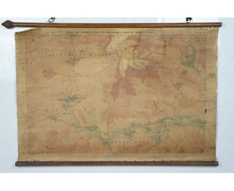
Lot 517
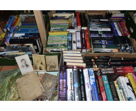
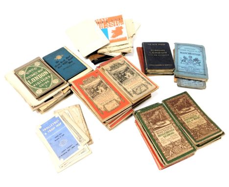
SIX BOXES OF BOOKS AND EPHEMERA, to include a school exercise book belonging to a George Picker, who went to Leadenham School, dated October 26th 1846, with a short note about George inside, three photographs of an Edwardian gentleman, two Shakespeare Memorial Theatre/ The Royal Shakespeare Theatre season programmes from the early 1960s, an Ordnance Survey map of Ruthin and surrounding areas dated 1879, approximately one hundred and forty books in hardback and paperback formats, mainly fiction including antiquarian and vintage titles, authors to include Kathy Reichs, Lynda La Plante, Terry Pratchett and Patricia Cornwell, with some history and other titles (6 boxes) (sd)
Lot 42
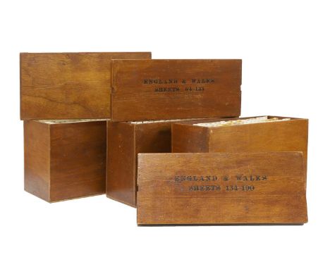
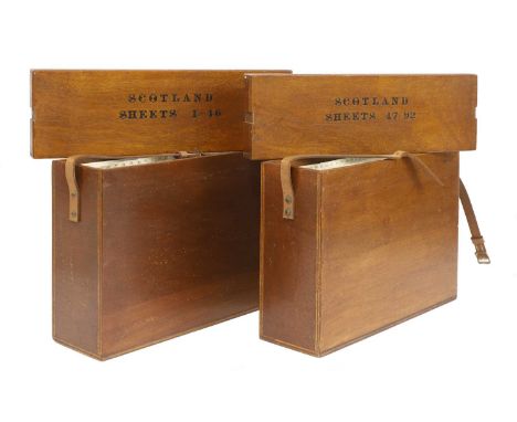
Ordnance Survey of England and Wales: Complete set of the 7th Series. 190 one-inch colour maps, each dissected into 6 sections laid on linen, with numbering tabs, preserved in the publisher’s three original purpose-made wooden map chests, each with the relevant index sheet pasted to the inside of the lid. Plus 3 index maps, plus a loosely inserted letter on 'Ordnance Survey' headed paper, dated 8 July 1959 and addressed to General R L Brown, CB. CBE. This set and the following set for Scotland, being retirement presents. A VERY GOOD/FINE SET (3)
Lot 227
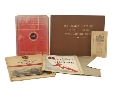
MILITARY, WW2: Bridging Normandy to Berlin, 1945, folio, DW, fully illustrated; Montgomery, Major General: The Story of the Fourth Army in the battles of the hundred days, August 8th to November 11th.1918. Map volume only, with 19 folding maps Plus 5 out of 7 folding Panoramic views; Letter from R L Brown, Brigadier director of Survey Allied forces Headquarters US Army, 16 Feb 1945. Presentation copy: enclosed, and present, a copy of 'the Advance on Rome'; A collection of General Montgomery’s personal messages to the Eight Army, 1944, in plain card boards; The Italian campaign 3 Sept 1943 – 2 May 1945 Royal Armoured Corps; Two ordnance survey maps: Aldershot Command; and Syria, Beirut section; 'Utah Beach to Cherbourg'. 1 October 1947, with the maps; 'Beachheads and Mountains'. Mediterranean Theatre of Operations, U.S. Army. June 1945; 'Fifteenth Air Force A Summary of its Operations and Results'. 1 November 1943 – 8 May 19. Classified Restricted; 'Goodbye to All This' 518 Field Survey Company. Royal Engineers. Inscribed by the men to Brigadier R.Ll.Brown OBE [Our client's Grandfather, he was head of survey for the 8th Army, and at AFHQ in Italy]; & 'History of AFHQ'. 9 paperback volumes. Volume 1 classified Confidential; remaining volumes classified Restricted (qty.)

Lot 337
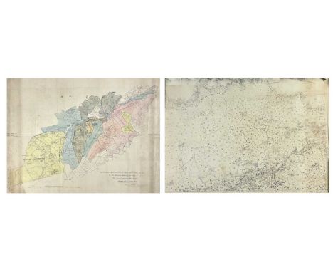
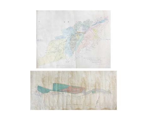
The Conyngham Plunkett Collection of Estate Maps relating to land owned in County Monaghan. Map of Robert Black’s Holding in Claddagh, Dromore and other holdings in other locations. Hand drawn and coloured. Folded maps. Circa 1780-1808. Some with description of property. Surveyors Alexr. Fleming, John Dolan and W. Douglas. William Plunkett , Lord Chancellor and other members of the distinguished family. A wonderful and unique collection of 27 original pre-Ordnance survey estate maps
Lot 721
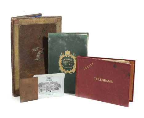
AN ORDNANCE SURVEY MAP OF YESTERC.1855paper on canvas, the green leather cover tooled with a crown and thistles and stamped 'W. & A.K. Johnstone, Edinburgh', together with an Edwardian gilt tooled leather stationery folder, the front applied with the Marquess of Tweeddale's crest and the motto 'Spare Nought', the back dated '1905', a Yester House Telegram folder, a Yester House glass ashtray and a copper bookplate engraved with the Marquess of Tweeddale's coat of arms (5)30cm (max)ProvenanceParker & Morris: The Art of Decorating.The Marquess of Tweeddale, Yester House, Gifford, East Lothian.PLEASE NOTE THAT THIS LOT IS TO BE OFFERED WITHOUT RESERVE.
Lot 109
London. Greenwood (C & J), Map of London from an actual survey made in the years 1824, 1825 & 1826..., Greenwood & Co, 1st edition, August 21st, 1827, large scale map engraved by James & Josiah Neele with contemporary colouring, sectionalised and laid on linen, calligraphic title, inset views of St Pauls and Westminster, dedication to King George IV, reference to the parishes and table of explanation, some offsetting, edged in green silk with slight fraying, 1260 x 1855 mm, bookplate of L. C. Berger to verso, contained within contemporary tree calf book box (rubbed and slightly worn) QTY: (1)NOTE:Howgego 309. The largest and finest map of London to be printed in the 19th century. The Greenwood brothers spent three years preparing this remarkable new survey, illustrating for the first time the planned development of Belgravia by Thomas Cubitt, the completion of the Grand Surrey Canal and Regent's Park one year before it was finished in 1828. No map provided greater detail or accuracy until the Ordnance Survey.
Lot 95
Folding Maps. A collection of 23 maps, 18th & 19th century, 23 engraved and lithographic map sheets of British county and regional maps and foreign maps and plans, all sectionalised and laid on linen, including examples by or after Walker, Philips, Wyld (including a four sheet map of Europe), Bowen, J & C Walker, 'The Times', Ordnance Survey, Hebner, Ebden, Assheton, Brué (map of France on four sheets) and Darton & Dix (county maps of Essex and Bedfordshire), various sizes and conditionQTY: (23)

Lot 123
The ‘Maiwand survivor’ Abyssinia and Afghanistan pair awarded to Major-General C. M. Griffith, 1st Bombay Grenadiers, who took over command of his Regiment after Colonel Anderson was severely wounded; when the inexperienced Jacob’s Rifles broke and fled, Griffith was ‘Conspicuous in his Efforts to Steady his Men’ and motivate the Bombay Grenadiers to ‘Fight On’, saving his Regiment’s reputation and averting a total disaster; afterwards he reconstituted a fighting unit from the surviving Grenadiers and commanded it during the Defence of Kandahar City and the subsequent victory at the Battle of Kandahar Abyssinia 1867 (Captn. C. M. Griffith. Bombay Staff Corps); Afghanistan 1878-80, 1 clasp, Kandahar (Lieut. Col. C. M. Griffith. Bo. N.I.) both fitted with contemporary silver riband buckles, nearly extremely fine (2) £4,000-£5,000 --- Charles Matthew Griffith was born at Poona on 19 October 1834, the son of Colonel Julius George Griffith, later General and Colonel Commandant, Bombay Artillery. He was educated at Cheltenham College, nominated as an HEIC Cadet, and passed the Military Committee at East India House on 4 February 1852. After being twice rejected for his weak English and Latin, he was admitted to Addiscombe on 6 August 1852, and commissioned Ensign in the Bombay Infantry on 8 June 1854, at the age of 19. He arrived in Bombay on 23 September 1854 for regimental service with the 1st Bombay Native Infantry (Grenadiers). From June 1859 he was variously employed with the Irregular Cavalry, the Sind Judicial and Police departments, and as Superintendent of Police for the Great Indian Peninsular Railway. The March to Fortress Magdala By 1868, Griffith was a Captain in the Bombay Staff Corps. He was first sent on active service during the Abyssinia Campaign, the most logistically challenging but among the best executed of the British expeditionary wars up to that time. He was given responsibility for organising and commanding ‘A’ Division Highland Transport Train, 1st Brigade of the 1st Division, Abyssinian Field Force. He also commanded the stretcher-bearers who recovered the wounded on 10 and 13 April 1868 from the battlefields of Arogee and Magdala. He was created Brevet Major on 15 August 1868 and was four times Mentioned in Despatches: London Gazette 16 June 1868: ‘The bandsmen and a party of Punjab muleteers were also organised under command of Captain Griffith and furnished with stretchers for the removal of wounded men from the field.’ London Gazette 30 June 1868: ‘Captain Griffith [and other officers] have distinguished themselves by their zeal and activity and deserve special notice.’ London Gazette 10 July 1868: ‘Captain Griffith [and other officers], Land Transport Corps, commanded the first Divisions that were raised, are strongly recommended by the Director of Transport Corps for the extent and value of their assistance.’ London Gazette 7 August 1868: ‘The working of the Train next comes into consideration, which commenced with the arrival of Captain Griffith, with the advance Brigade... The Train was divided into four divisions... and Captain Griffith commenced the formation of “A” Mules... Difficulties and disasters met these officers at every step. Mules landed without equipment in hundreds, and with muleteers of the class already spoken of. At that time these officers having no subordinates had to look to everything themselves... The pleasing task now remains of bringing to the special notice of His Excellency the names of such officers more especially deserving of his kind consideration, and whose efforts came under the personal observation of the Director, who from first to last, never failed... Captain C. M. Griffith, Bombay Staff Corps.’ Griffith was granted furlough to England from 10 October 1868 to 22 November 1870. After marrying and returning to India, he was appointed Brigade Major, Aden in November 1871, promoted Major in June 1874, and Lieutenant-Colonel in July 1877. In August 1879, at the age of 44, he was appointed officiating Second in Command of 1st Bombay Grenadiers, considered to be an elite Indian regiment smartly turned out in a uniform of red jacket, khaki turban and dark blue trousers with white gaiters. Griffith accompanied his regiment to join the South Afghanistan Field Force via the Bolan and Khojak Passes in October 1879, experiencing the hostile, anti-British environment of the Kandahar region for many months. In July 1880 a column built around Brigadier Burrows’s 1st Brigade, which included the Bombay Grenadiers, was sent west to Girishk on the Helmand river. At the disastrous battle of Maiwand on 27 July 1880, Griffith initially commanded the Grenadier’s Right Wing, and then took command of the whole Regiment at around 3pm, after Colonel Anderson was severely wounded and evacuated. Maiwand Two months later, in mid-September 1880, the British, including some officers who had survived the massacre, revisited the battlefield. They found that the European and Indian bodies had been left to disintegrate where they fell, but, learning of the British return, local Afghan villagers had hastily buried them just days before in 40 separate shallow graves at the places where they had died. The battlefield was carefully surveyed and the graves plotted on the battle map, then opened and their contents recorded. The correlation of the battlefield survey with the unsatisfactory and evasive official despatches of the force commanders was so contradictory that each surviving officer was ordered to submit a written report outlining what he had directly witnessed. Lieutenant-Colonel Griffith’s official account is quoted below, slightly abridged, while extracts of accounts given by other officers mentioning Griffith are inserted in italics. ‘On the 26th July 1880, the force under Brigadier-General Burrows [personally brave but indecisive, cautious and totally inexperienced in commanding an all-arms force], which consisted of the following troops [2,600 men], were encamped at Khushk-i-Nakhud, which is on the road from Kandahar to Girishk on the Helmand and distant from the former place about fifty miles: E-B, Royal Horse Artillery [146 men]; Detachment [260 men], 3rd Sind Horse; Detachment [315 men] 3rd Light Cavalry; Detachment [46 men] Bombay Sappers and Miners; 66th Foot [473 men]; 1st Bombay Grenadiers [649 men, the largest infantry unit in the force]; and Jacob's Rifles [624 men]. It was generally believed… that an Afghan force, consisting of about 20,000 men and 36 guns, under Ayub Khan, was not far distant; but such was the enmity against us, that neither the political officers nor our own cavalry patrols were able to obtain reliable information either as to the correct numbers or the exact position of the Afghan force. However, information was received that a few ghazis and some cavalry of Ayub Khan’s advanced guard had occupied the village of Maiwand… and during the night orders were issued for our brigade to march on Maiwand the next morning [27 July] at 6:30 a.m. The position occupied by Ayub Khan’s army at this time was unknown. Owing to the large quantity of ordnance and commissariat stores which had been stowed away within walled enclosures at Khushk-i-Nakhud, and the loading of which took a considerable time, the force did not start punctually, and the sun was well up, and the heat considerable, before we were all off the ground. The force advanced with cavalry and two guns of E-B, Royal Horse Artillery, in advance; the infantry in line of columns at deploying distance; baggage on the right flank; and the whole brought up by a rear-guard of two guns and some cavalry, each regiment of infantry ...

Lot 492
Map. 1922 Ordnance Survey One Inch of Bristol District. Special Sheet Popular Edition. Includes Glos, Wilts & Somerset. Redwick at NW then Avonmouth, Iron Acton, Chipping Sodbury, Colerne at East, Farleigh Hungerford at SE, West Harptree at South, SW with Winscombe and Clevedon at West on Bristol Channel. Cloth backed.
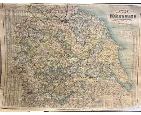
Lot 682
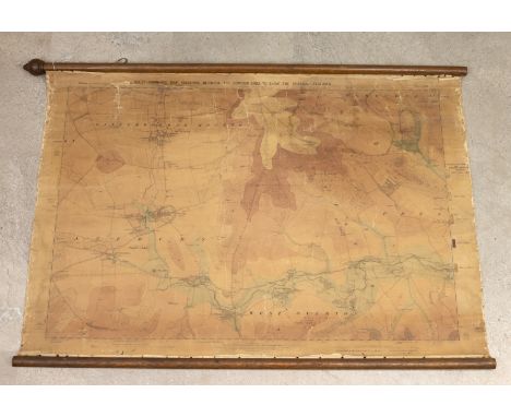
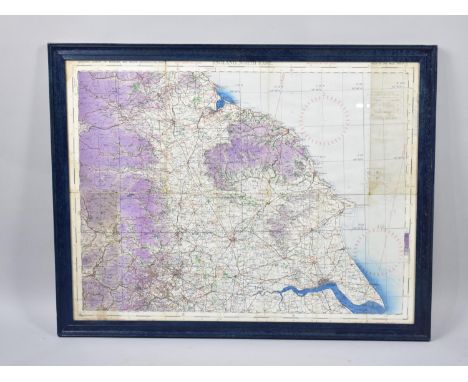
"Bacon's Excelsior map of Yorkshire and parts of the joining Counties showing Railways, Roads, Elevations and Distances also Local Government Divisions, revised according to the latest Ordnance Survey', a hanging wall map with index to boroughs, urban and rural districts and index - Gazetteer, printed by John Bartholomew & Co Edinburgh, H88cm W117cm

Lot 438
Maps. Lake District. Three folding maps: Otley, J. - A Correct Map of the Lake District; with the Height of the Principal Hills, Their Bearings and Distances; the Stages, and Interesting Excursions. Keswick: 1841. Original textured cloth covers; Walker, J. & C. - Westmorland. London: 1841. Loose in original covers. With; an 1863 Ordnance Survey map of Westmorland. (3)
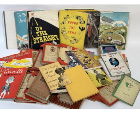
Lot 121
A large collection of various works comprising, a collection of various Ordnance Survey One-Inch Map of Scotland Inverness and Fort Augustus etc and a group of Russell Brockbank books- Up the Straight, The Brockbank Omnibus and The Grand Prix etc and various other books eg - The Hunting of the Snark by Lewis Carroll and A Dictionary of R.A.F Slang etc. (alot)
Lot 234
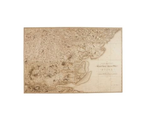
Lt. Col. William Mudge. The Second Part of the General Survey of England and Wales Containing the Whole of Devon and a Portion of the Adjoining Counties, done by the Surveyors of His Majesties Ordnance under the Direction of Lt. Col. Mudge of the Royal Artillery, F.R.S., large scale map in eight sections, numbered XX to XXVII with engraved piano key border (to perimeter sheets only), contemporary quarter calf with marbled boards rebacked, folio, 1809.occasional light spotting and browning, end papers with creases, spine rebacked and extremities scuffed.

Lot 1207
"Bacon's Excelsior map of Yorkshire and parts of the joining Counties showing Railways, Roads, Elevations and Distances also Local Government Divisions, revised according to the latest Ordnance Survey', a hanging wall map with index to boroughs, urban and rural districts and index - Gazetteer, printed by John Bartholomew & Co Edinburgh, H88cm W117cm
Lot 488
WW2 German Battle of Britain Luftwaffe Navigator's London Bombing Map This rare single sided waterproof map shows London West 1:20000. The map highlighting important buildings, targets etc. Including Wellington Barracks, Albert Hall, British Museum, Buckingham Palace, etc. Used condition, with one crude repair. The key is in German and the map is taken from a 1933 Ordnance Survey Map of central London. Approx. Size 38 x 28 Inches INVOICE PAYABLE ON PRESENTATION BY BANK TRANSFER ONLY
Lot 177
St . Ives. 'Copy from Ordnance Maps to show Leases and accompany Report of October 8th 1907.....The Cornish Proprietary Mines Limited,' printed map with coloured areas showing names of ownership, tear to fore edge, some nibbles to edges, generally good to very good, 88cm x 108cm, [1907]; 'Section of Standard or Virgin Lode' cross sectional view, hand drawn on linen, showing Rosewall Hill and Ransom United Mines, Saint Ives Consol Mines, vg to fine, rolled, 25.5cm x 55cm; With three other related works including an exceedingly long (approx 482cm) preparatory sketch of a mine survey. (5) From the estate of Ron Hooper, M.V.O., A.C.S.M., F.I.M.M.Born in St.Agnes, he graduated from Camborne School of Mines. After a short career mining in the Gold Coast of Ghana he joined the Camborne School of Mines, eventually becoming Senior Lecturer in Surveying. At the same time, he acted as an independent mining engineer and was appointed mineral agent for several Cornish estates including the Duchy of Cornwall, Tregothnan, and the Godolphin Estate (amongst others).
Lot 164
'Trenwith Mine, St Ives,' Surveys and maps by Leonard Hawkey, 1911. Hand drawn cross sectional survey on thin linen by L. Hawkey, scale 1 inch to 5 fathoms, showing Victory Shaft, Berriman Shaft and Old Sump Shaft, reference of Adit Level, damp staining to edges, colour ink offsetting, rolled, approx 75cm x 215cm, 1911; 'Longitude Section', scale 1 inch to 5 fathoms, damp staining and nibbles to edge, rolled, approx, 75cm x 220cm [L. Hawkey, 1911]; Handrawn map on linen, with scale and compass, showing mine burrows, Stennack Road and Trenwith Terrace, damp staining, rolled, approx, 65.5cm x 143cm, [L. Hawkey, 1911], '....Berriman Shaft, Transverse Section,' hand drawn, scale 1 inch = 30 feet or 5 fathoms, damp staining to edges, approx 56cm x 21cm on much larger thin linen, rolled, [L. Hawkey, 1911]; With the same for 'Old Sump Shaft' and 'Victory Shaft'; Hand drawn survey both transverse and longitudinal sections for 'East Virgin Shaft and Sump Shaft', on linen with damp staining to edge, rolled, approx 68cm x 100cm, [L. Hawkey, 1911]; 'St Ives. Ordnance Map to show Leases and accompany Report of October 8th 1907,' tears and nibble to edges, rolled, approx 88cm x 109cm. (8)Surveyed by Hawkey during the reopening of the mine, by the German-owned 'British Radium Company' for the extraction of uranium (and radium). A fascinating survivor of subterranean St. Ives. From the estate of Ron Hooper, M.V.O., A.C.S.M., F.I.M.M.Born in St.Agnes, he graduated from Camborne School of Mines. After a short career mining in the Gold Coast of Ghana he joined the Camborne School of Mines, eventually becoming Senior Lecturer in Surveying. At the same time, he acted as an independent mining engineer and was appointed mineral agent for several Cornish estates including the Duchy of Cornwall, Tregothnan, and the Godolphin Estate (amongst others).
Lot 792
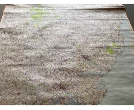
GROUP OF UNFRAMED MAPS including Ordnance Survey (Scotland and England) and anglers river mapsSalmon pools on the river Tay x2 100cm x 35cm overall good condition Salmon pools on the river cassley 62cm x 24cm overall good condition 1909 map of Yorkshire (west riding) sheet CLIII.5 104cm x 74cm. Decent condition small tears around the edges.1909 map of Yorkshire (west riding) sheet CLIII.2 104cm x 74cm decent condition small folds and tears around the edges1909 map of Yorkshire (west riding) sheet CLIII.3 104cm x 74cm similar condition to previous 1909 map of Yorkshire (west riding) sheet CLIII.1 104cm x 74cm similar condition to previousordinance survey of Yorkshire sheet SE15NE 56cm x 73cm overall good condition ordinance survey of Yorkshire sheet SE15NW 56cm x 73cm overall good condition
Lot 84
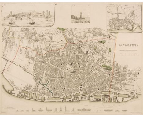
Liverpool. Starling (T.). Liverpool, published under the Superintendence of the Society for the Diffusion of Useful Knowledge, circa 1830, engraved map with contemporary outline colouring, 310 x 385 mm, together with Davies (B. R.), Liverpool and its Environs including the Cheshire Coast, circa 1830, engraved map after a survey by H. Austen, contemporary outline colouring, sectionalised and laid on linen, slight staining, some surface abrasion with loss, 445 x 530 mm, bound in contemporary cloth boards with gilt title to the upper cover, re-backed, size of boards 100 x 150 mm, with Philip (George & Son). Philips' Plan of the Town & Port of Liverpool with Birkenhead and the adjoining Cheshire Coast, circa 1860, engraved map with contemporary outline colouring, sectionalised and laid on linen, some later ink annotations, slight toning and dust soiling, 625 x 715 mm, bound in contemporary cloth boards with gilt title to the upper cover, size of boards 170 x 135 mm, plus Ordnance Survey (publishers). Untitled map of Liverpool and its environs, on a scale of six inches to a mile, 22nd September 1851, uncoloured engraved map, sectionalised and laid on linen, slight staining, 620 x 930 mm, contemporary cloth boards, upper board detached, spine crudely repaired, size of boards 225 x 145 mmQTY: (4)
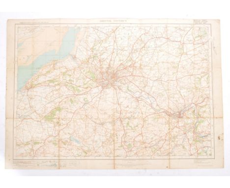
Lot 481
Map. 1922 Ordnance Survey One Inch of Bristol District. Special Sheet Popular Edition. Includes Glos, Wilts & Somerset. Redwick at NW then Avonmouth, Iron Acton, Chipping Sodbury, Colerne at East, Farleigh Hungerford at SE, West Harptree at South, SW with Winscombe and Clevedon at West on Bristol Channel. Cloth backed.
Lot 406
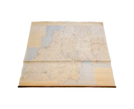
A large early 20th century 1921 linen backed survey map of Gloucestershire & Wiltshire printed and published by the Director General at the Ordnance Survey Office, Southampton. The map presenting a label for Edward Stanford Ltd, Cartographers to the King. Edition of 1921. Sheet LXXIV & Sheet XIX. housed on wall mounted roller fixing. Altogether measures approx. 277cm x 220cm.
Lot 400
A collection of books on Topography, Royalty, Art etc, together with printed ephemera to include theatre programmes and maps, to include an Ordnance Survey map of Northwich and Macclesfield, a W. H. Smith and Sons, 'Map of Environs of London', a Bartholomew's map of 'Cheshire', 'The Contour Road Book of England, Northern Edition' and others
Lot 295
Nottingham.- Ordnance Survey Office (publisher) Collection 8 geological maps on the environs of Nottingham, engravings with full hand-colouring, in various formats and sizes between 295 x 425 mm (11 5/8 x 16 5/8 in) and 595 x 885 mm (23 1/2 x 34 7/8 in), dissected and mounted on linen, each folding with red marbled endpanel and library stamp into later slipcase, label to spine reads 'Ordnance Survey/ Geological Map/ of Notts. 1850/ L96', 8vo, [mid-19th century]
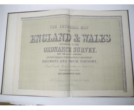
Lot 7325
(Atlas.) John Bartholomew: 'The Imperial Map of England & Wales According to the Ordnance Survey, with the Latest Additions; Shewing clearly every Feature of the Country, Railways and their Stations, Roads, Canals, Rivers, Gentlemen's Seats &c. &c., On a Scale of 4 Miles to an Inch', London & Edinburgh, A. Fullarton & Co., c.1872, double page lithograph title + 17 sheets comprising 14 large double page colour maps (sheets 2-15) and final map (sheet 16) divided into 3 separate half height double page colour maps (16A, B & C respectively), 4pp index at front, large slim folio (approx. 56 x 42cm) original cloth gilt
Lot 379
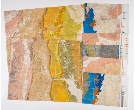
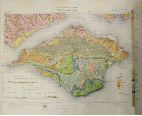
A collection of Geological and Ordnance Survey Maps, a rolled-up Ordnance Survey map of The Geological Survey of the Isle of Wight. Dated 1885, Printed for Ordnance Survey in 1926. Reprinted in colour with emendations in 1935, 55x72cm, other similar Geological maps - Cornwall and Isles of Scilly Published 1909, reprinted 1951, Aldershot, Birmingham; Harrogate, Reigate, Dartford, Dudley.Condition report:Harrogate - folded, some increasing to the margins.York - folded, creases to the margins especially along the vertical centre foldGloucestershire - folded into eight sections. Well handled, some discolouration.Birmingham - folded into 16 sections. Annotated with black and red biro. All over discolouration.Sheet SO74 - folded, general grubbiness and discolouration.London tourist map, revised 1921, heavily folded, some tears along the crease lines.Aldershot - heavily creased, pencil annotations.Isle of Wight, Cornwall, six others are flat sheets but curled, well handled with creases and discolouration to the margins.
Lot 123
Mudge, William Part the First of the General Survey of England and Wales, containing the whole of Essex and a Portion of the Adjoining Counties. [London]: by the Surveyors of His Majesty's Ordnance under the Direction of Lt. Col. Mudge of the Royal Artillery, F.R.S., [1805]. First edition, large engraved map, 122 x 183cm, divided into 32 sections and laid on linen, light toning, a hint of offsetting, housed in contemporary straight-grain red morocco bookform pull-off case (rubbed);together with 4 books on Essex (including Philip Morant, A New and Complete History of Essex, Chelmsford, 1770-2, volumes 1-3 and 5-6 of 6 only, with numerous engraved plates; Thomas Wright, The History ... of ... Essex, c.1840, 2 volumes, 4to, engraved plates by W. H. Bartlett)(5) Mudge's map of Essex was the second Ordnance Survey map to be published, after Kent in 1801.
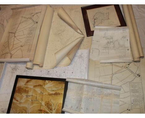
![Atlas. John Bartholomew FRGS (1831-1893) - The Imperial Map of England & Wales according to the Ordnance Survey [...], On](https://cdn.globalauctionplatform.com/662cb969-5584-4034-a004-b10000c209d5/d2ad8d8d-89ce-4adc-bc0a-b100010795bd/468x382.jpg)
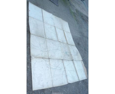
Lot 25
Atlas. John Bartholomew FRGS (1831-1893) - The Imperial Map of England & Wales according to the Ordnance Survey [...], On the Scale of 4 Miles to an Inch, London & Edinburgh: J. Fullarton & Co., n.d. [1866], 16 double-page chromolithographed maps, of which sheet 16 is divided into 3 separate maps, [2]ff (index), some foxing, original quarter-calf over cloth by W. Loxley of Melton, his ticket, upper-cover lettered in gilt, split, chipped and rubbed, but holding, folio (56 x 40.5cm), & Archer (Thomas) & Barnard (Frederick, illustrator), Charles Dickens: A Gossip about his Life, Works, and Characters, London: Cassell & Company, Limited, n.d. [1894], full-page photogravures and in-text illustrations, contemporary quarter-morocco over cloth, pictorial gilt, worn, folio (45.5 x 36cm), (2)
-
1613 item(s)/page