We found 1759 price guide item(s) matching your search

Refine your search

Year

Filter by Price Range
  • List
  • Grid
  • 1759 item(s)
    /page

Lot 1207

"Bacon's Excelsior map of Yorkshire and parts of the joining Counties showing Railways, Roads, Elevations and Distances also Local Government Divisions, revised according to the latest Ordnance Survey', a hanging wall map with index to boroughs, urban and rural districts and index - Gazetteer, printed by John Bartholomew & Co Edinburgh, H88cm W117cm

Lot 1806

A framed vintage Ordnance Survey map print of Great Britain - sold with a framed monochrome map of Heavitree Ward and two map reprints

Lot 642

A case containing a collection of Ordnance Survey maps with 'War Revision 1940' text, also vintage map related publications

Lot 488

WW2 German Battle of Britain Luftwaffe Navigator's London Bombing Map This rare single sided waterproof map shows London West 1:20000. The map highlighting important buildings, targets etc. Including Wellington Barracks, Albert Hall, British Museum, Buckingham Palace, etc. Used condition, with one crude repair. The key is in German and the map is taken from a 1933 Ordnance Survey Map of central London. Approx. Size 38 x 28 Inches INVOICE PAYABLE ON PRESENTATION BY BANK TRANSFER ONLY

Lot 177

St . Ives. 'Copy from Ordnance Maps to show Leases and accompany Report of October 8th 1907.....The Cornish Proprietary Mines Limited,' printed map with coloured areas showing names of ownership, tear to fore edge, some nibbles to edges, generally good to very good, 88cm x 108cm, [1907]; 'Section of Standard or Virgin Lode' cross sectional view, hand drawn on linen, showing Rosewall Hill and Ransom United Mines, Saint Ives Consol Mines, vg to fine, rolled, 25.5cm x 55cm; With three other related works including an exceedingly long (approx 482cm) preparatory sketch of a mine survey. (5) From the estate of Ron Hooper, M.V.O., A.C.S.M., F.I.M.M.Born in St.Agnes, he graduated from Camborne School of Mines. After a short career mining in the Gold Coast of Ghana he joined the Camborne School of Mines, eventually becoming Senior Lecturer in Surveying. At the same time, he acted as an independent mining engineer and was appointed mineral agent for several Cornish estates including the Duchy of Cornwall, Tregothnan, and the Godolphin Estate (amongst others).

Lot 164

'Trenwith Mine, St Ives,' Surveys and maps by Leonard Hawkey, 1911. Hand drawn cross sectional survey on thin linen by L. Hawkey, scale 1 inch to 5 fathoms, showing Victory Shaft, Berriman Shaft and Old Sump Shaft, reference of Adit Level, damp staining to edges, colour ink offsetting, rolled, approx 75cm x 215cm, 1911; 'Longitude Section', scale 1 inch to 5 fathoms, damp staining and nibbles to edge, rolled, approx, 75cm x 220cm [L. Hawkey, 1911]; Handrawn map on linen, with scale and compass, showing mine burrows, Stennack Road and Trenwith Terrace, damp staining, rolled, approx, 65.5cm x 143cm, [L. Hawkey, 1911], '....Berriman Shaft, Transverse Section,' hand drawn, scale 1 inch = 30 feet or 5 fathoms, damp staining to edges, approx 56cm x 21cm on much larger thin linen, rolled, [L. Hawkey, 1911]; With the same for 'Old Sump Shaft' and 'Victory Shaft'; Hand drawn survey both transverse and longitudinal sections for 'East Virgin Shaft and Sump Shaft', on linen with damp staining to edge, rolled, approx 68cm x 100cm, [L. Hawkey, 1911]; 'St Ives. Ordnance Map to show Leases and accompany Report of October 8th 1907,' tears and nibble to edges, rolled, approx 88cm x 109cm. (8)Surveyed by Hawkey during the reopening of the mine, by the German-owned 'British Radium Company' for the extraction of uranium (and radium). A fascinating survivor of subterranean St. Ives. From the estate of Ron Hooper, M.V.O., A.C.S.M., F.I.M.M.Born in St.Agnes, he graduated from Camborne School of Mines. After a short career mining in the Gold Coast of Ghana he joined the Camborne School of Mines, eventually becoming Senior Lecturer in Surveying. At the same time, he acted as an independent mining engineer and was appointed mineral agent for several Cornish estates including the Duchy of Cornwall, Tregothnan, and the Godolphin Estate (amongst others).

Lot 792

GROUP OF UNFRAMED MAPS including Ordnance Survey (Scotland and England) and anglers river mapsSalmon pools on the river Tay x2 100cm x 35cm overall good condition Salmon pools on the river cassley 62cm x 24cm overall good condition 1909 map of Yorkshire (west riding) sheet CLIII.5 104cm x 74cm. Decent condition small tears around the edges.1909 map of Yorkshire (west riding) sheet CLIII.2 104cm x 74cm decent condition small folds and tears around the edges1909 map of Yorkshire (west riding) sheet CLIII.3 104cm x 74cm similar condition to previous 1909 map of Yorkshire (west riding) sheet CLIII.1 104cm x 74cm similar condition to previousordinance survey of Yorkshire sheet SE15NE 56cm x 73cm overall good condition ordinance survey of Yorkshire sheet SE15NW 56cm x 73cm overall good condition 

Lot 84

Liverpool. Starling (T.). Liverpool, published under the Superintendence of the Society for the Diffusion of Useful Knowledge, circa 1830, engraved map with contemporary outline colouring, 310 x 385 mm, together with Davies (B. R.), Liverpool and its Environs including the Cheshire Coast, circa 1830, engraved map after a survey by H. Austen, contemporary outline colouring, sectionalised and laid on linen, slight staining, some surface abrasion with loss, 445 x 530 mm, bound in contemporary cloth boards with gilt title to the upper cover, re-backed, size of boards 100 x 150 mm, with Philip (George & Son). Philips' Plan of the Town & Port of Liverpool with Birkenhead and the adjoining Cheshire Coast, circa 1860, engraved map with contemporary outline colouring, sectionalised and laid on linen, some later ink annotations, slight toning and dust soiling, 625 x 715 mm, bound in contemporary cloth boards with gilt title to the upper cover, size of boards 170 x 135 mm, plus Ordnance Survey (publishers). Untitled map of Liverpool and its environs, on a scale of six inches to a mile, 22nd September 1851, uncoloured engraved map, sectionalised and laid on linen, slight staining, 620 x 930 mm, contemporary cloth boards, upper board detached, spine crudely repaired, size of boards 225 x 145 mmQTY: (4)

Lot 281

A group of England and Wales maps, including Ordnance Survey, Bartholomew's, Reynolds New Distance map of London and visitors guide, Geographia large scale plan of Manchester, Henstock & Faulkes' cycling map of seventy miles about Liverpool, further maps and guides. (qty)

Lot 481

Map. 1922 Ordnance Survey One Inch of Bristol District. Special Sheet Popular Edition. Includes Glos, Wilts & Somerset. Redwick at NW then Avonmouth, Iron Acton, Chipping Sodbury, Colerne at East, Farleigh Hungerford at SE, West Harptree at South, SW with Winscombe and Clevedon at West on Bristol Channel. Cloth backed.

Lot 406

A large early 20th century 1921 linen backed survey map of Gloucestershire & Wiltshire printed and published by the Director General at the Ordnance Survey Office, Southampton. The map presenting a label for Edward Stanford Ltd, Cartographers to the King. Edition of 1921. Sheet LXXIV & Sheet XIX. housed on wall mounted roller fixing. Altogether measures approx. 277cm x 220cm.

Lot 400

A collection of books on Topography, Royalty, Art etc, together with printed ephemera to include theatre programmes and maps, to include an Ordnance Survey map of Northwich and Macclesfield, a W. H. Smith and Sons, 'Map of Environs of London', a Bartholomew's map of 'Cheshire', 'The Contour Road Book of England, Northern Edition' and others

Lot 511A

19th Century Ordnance Survey map of Avebury published in 1899, printed on paper and fabric mounted with wooden supports to top and bottom.

Lot 295

Nottingham.- Ordnance Survey Office (publisher) Collection 8 geological maps on the environs of Nottingham, engravings with full hand-colouring, in various formats and sizes between 295 x 425 mm (11 5/8 x 16 5/8 in) and 595 x 885 mm (23 1/2 x 34 7/8 in), dissected and mounted on linen, each folding with red marbled endpanel and library stamp into later slipcase, label to spine reads 'Ordnance Survey/ Geological Map/ of Notts. 1850/ L96', 8vo, [mid-19th century]  

Lot 7325

(Atlas.) John Bartholomew: 'The Imperial Map of England & Wales According to the Ordnance Survey, with the Latest Additions; Shewing clearly every Feature of the Country, Railways and their Stations, Roads, Canals, Rivers, Gentlemen's Seats &c. &c., On a Scale of 4 Miles to an Inch', London & Edinburgh, A. Fullarton & Co., c.1872, double page lithograph title + 17 sheets comprising 14 large double page colour maps (sheets 2-15) and final map (sheet 16) divided into 3 separate half height double page colour maps (16A, B & C respectively), 4pp index at front, large slim folio (approx. 56 x 42cm) original cloth gilt

Lot 379

A collection of Geological and Ordnance Survey Maps, a rolled-up Ordnance Survey map of The Geological Survey of the Isle of Wight. Dated 1885, Printed for Ordnance Survey in 1926. Reprinted in colour with emendations in 1935, 55x72cm, other similar Geological maps - Cornwall and Isles of Scilly Published 1909, reprinted 1951, Aldershot, Birmingham; Harrogate, Reigate, Dartford, Dudley.Condition report:Harrogate - folded, some increasing to the margins.York - folded, creases to the margins especially along the vertical centre foldGloucestershire - folded into eight sections. Well handled, some discolouration.Birmingham - folded into 16 sections. Annotated with black and red biro. All over discolouration.Sheet SO74 - folded, general grubbiness and discolouration.London tourist map, revised 1921, heavily folded, some tears along the crease lines.Aldershot - heavily creased, pencil annotations.Isle of Wight, Cornwall, six others are flat sheets but curled, well handled with creases and discolouration to the margins.

Lot 791

A framed reproduction of the 1st edition Ordnance Survey map (originally published 1809-11) of Dorset, overall size 92cm x 73cm.

Lot 439

Carey: an early 19th century hand-coloured map of Oxfordshire and an early Ordnance Survey map of Oxfordshire, in Hogarth frame

Lot 263

Two stamp albums, containing GB and world stamps, for Germany, France, Czechoslovakia, Canada, Australia, New Zealand, etc., together with an Ordnance Survey map for Cambridge and Ely, Huntingdon and Peterborough, Stamford, a Snowden's map of Peterborough, etc.

Lot 5

Ordnance Survey 1":1 mile Lake District map on board, 84 cm x 105 cm

Lot 600

Large Ordnance Survey Map of Eastern England dated to circa 1947, linen backed, in two sections, each about 213 x 170cm and mounted with a wooden top-rail for wall hanging

Lot 123

Mudge, William Part the First of the General Survey of England and Wales, containing the whole of Essex and a Portion of the Adjoining Counties. [London]: by the Surveyors of His Majesty's Ordnance under the Direction of Lt. Col. Mudge of the Royal Artillery, F.R.S., [1805]. First edition, large engraved map, 122 x 183cm, divided into 32 sections and laid on linen, light toning, a hint of offsetting, housed in contemporary straight-grain red morocco bookform pull-off case (rubbed);together with 4 books on Essex (including Philip Morant, A New and Complete History of Essex, Chelmsford, 1770-2, volumes 1-3 and 5-6 of 6 only, with numerous engraved plates; Thomas Wright, The History ... of ... Essex, c.1840, 2 volumes, 4to, engraved plates by W. H. Bartlett)(5) Mudge's map of Essex was the second Ordnance Survey map to be published, after Kent in 1801.

Lot 2114

A 1922 ORDNANCE SURVEY LARGE SCALE WALL MAP OF THE PARISH OF SWERFORD

Lot 241

A Framed Ordnance Survey RAF WW2 Second Edition Map of England, North East, 70x50cms

Lot 25

Atlas. John Bartholomew FRGS (1831-1893) - The Imperial Map of England & Wales according to the Ordnance Survey [...], On the Scale of 4 Miles to an Inch, London & Edinburgh: J. Fullarton & Co., n.d. [1866], 16 double-page chromolithographed maps, of which sheet 16 is divided into 3 separate maps, [2]ff (index), some foxing, original quarter-calf over cloth by W. Loxley of Melton, his ticket, upper-cover lettered in gilt, split, chipped and rubbed, but holding, folio (56 x 40.5cm), & Archer (Thomas) & Barnard (Frederick, illustrator), Charles Dickens: A Gossip about his Life, Works, and Characters, London: Cassell & Company, Limited, n.d. [1894], full-page photogravures and in-text illustrations, contemporary quarter-morocco over cloth, pictorial gilt, worn, folio (45.5 x 36cm), (2)

Lot 1143

A large folder containing a large Ordnance Survey map of Trewyn Manor and adjoining estates, The Property of J.L. Rosher Esq.

Lot 21

An Ordnance Survey one inch map for Land's End & Lizard - fifth edition, together with Bartholomew's map of Cornwall, Bacon's map of Scotland, an illustrated map of the Nile and an Enid Blyton novel.

Lot 134

Posters - Map of the Town of Swaffham and surrounding areas. Vintage measurements 61cm x 61cm, Hunstanton (Norfolk) Survey map 1905, measurements 104cm x 74cm, Ordnance Survey Map (Second Edition 1905) North Western Division Walsingham Union and R.D. Measurements 110cm x 73cm slight tear and damage around edge of poster and Norfolk - Map of the parish of Topcroft 1807. Reference of properties and rent paid yearly signifies land copy hold, measurements 94cm x 76cm.

Lot 60

Map - ordnance Survey Map of Central Norfolk 1980, by J.B. Harvey, scale 11 inch - 1 statuary mile, measurements 95cm x 77cm, fold marks in map, good condition

Lot 2798

History, Scotland – Groome (Francis H., ed.) Ordnance Gazetteer of Scotland: A Survey of Scottish Topography, new edn., London, William Mackenzie, n. d. (c. 1890), large 8vo, Vols. III-VI of (6), photographic frontis., fold out maps and vignettes, gilt edges, bound gilt embossed blue boards, gilt spine titles, latter rubbed and dirty; Beattie (William), Scotland, Illustrated in a series of Views taken Expressly for this Work by Messrs. T. Dillon, W. H. Bartlett & H. McCullock, 2 vols., London, George Virtue 1838, 121 engraved plates, folding map watered endpapers, bound black and gilt bevelled and embossed boards, gilt titles to spine, Vol. I: 200pp, Vol. II. 164pp (6)

Lot 455

Small range of early 20th Century foldout Ordnance Survey / Road maps to include; Ordnance Survey Contoured Map of Bournemouth and Swanage, Ordnance Survey England & Wales – Sheet 106 [Forster Groom & Co Ltd], Ordnance Survey Tourist Map New Forest, Ordnance Survey Contoured Road Map of Truro, Cycling & County Maps – 2” Salisbury Plain [Forster Groom & Co Ltd], Touring Atlas of the British Isles – Specially Prepared for Cyclists, Motorists & Travellers [Ward, Lock & Co, London, 1909] & Phillips’ Cyclists Map of North Wales [The London Geographical Institute]. (7)

Lot 87

BARTHOLOMEW JAMES.  The Imperial Map of England & Wales according to the Ordnance Survey. Large double page eng. title, 14 double page col. maps (sheets 2-15 plus sheet 16 which has been sliced & is tipped in at the end). No letterpress title, commences at Index leaf. Large quarto. Rubbed black leather gilt. N.d. (a.f.).

Lot 233

BARTHOLOMEW JOHN.  New Reduced Ordnance Survey Map of the Counties of Lanark, Renfrew, Ayr, Stirling, Dumbarton &c. Fldg. eng. col. map in orig. brds.; also 9 others, Scottish local history, topography, etc.  (10).

Lot 1462

LOCAL INTEREST; an Ordnance Survey map of Mobberley Village Society, a framed set of twelve Cries of London miniature prints, and a pair of hunting prints (4)

Lot 658

Ephemera, Transport, a good Aldershot District Traction Company selection, inc. season ticket for 1943, booklet for conductors regulations (1927) and rules for drivers (1928), bus tickets (23), share certificate which also shows a map of Traco bus services for 1927 and 6 parcel labels. Sold with Ordnance Survey map of Aldershot linen backed and published in 1900 (mainly gd)

Lot 517

*Local Interest - An Ordnance Survey Map of Cumbria, Sheet SD 49 NW, scale 1:10000, showing Windermere and surrounding area, framed and under glass, measuring 59cm x 69cm overall, & a coloured print, after John Atkinson Grimshaw (1836-1893, British), entitled 'Liverpool Quay By Twilight', also framed and under glass

Lot 485

Edwards Jay - A companion from London to Brighthelmston, in Sussex, published London 1801, one half leather bound volume; together with other maps, being Ordnance Survey canvas backed map of England and Wales, one other English Lakes, one other Brecknockshire etc

Lot 92

A First World War trench map & books - trench map of Belgium & France sheet 51 Edition 2 N. Published for the British General Staff Geographical Section by the Ordnance Survey Southampton October 1917. Scale 1:40000. On folding linen. Along with a  British Army map on linen of part of the French and Belgian frontier and x3 books on the war on the Western Front-The Topography of Armageddon, a reference guide to trench maps; A New Guide to the Battlefields of France and In Search of the Better ‘Ole (a biography of Bruce Bairnsfather)

Lot 331

Nottingham.- Ordnance Survey Office (publisher) Collection 8 geological maps on the environs of Nottingham, engravings with full hand-colouring, in various formats and sizes between 295 x 425 mm (11 5/8 x 16 5/8 in) and 595 x 885 mm (23 1/2 x 34 7/8 in), dissected and mounted on linen, each folding with red marbled endpanel and library stamp into later slipcase, label to spine reads 'Ordnance Survey/ Geological Map/ of Notts. 1850/ L96', 8vo, [mid-19th century]

Lot 75

British Isles. Walker (J. & C.). Map of the British Isles Showing the Cities, Borough & Market Towns, The Principal Villages, Railways, Mail & Turnpike Roads, Navigable Rivers & Canals with the Soundings & Sand Banks round the Coast, sold by Edward Stanford, circa 1850, engraved map with contemporary wash colouring, sectionalised and laid on linen, calligraphic title, table of explanation, inset maps of the Scilly Isles and the Shetland & Orkney Islands, endpapers as advertisements for Edward Stanford, 1240 x 1065 mm, together with Cruchley (GH. F. publisher). North of England with part of Scotland from the Ordnance Survey, circa 1860, engraved map with contemporary outline colouring, sectionalised and laid on linen, some dust soiling and slight staining, some staining to the verso, marbled endpapers, 1450 x 1570 mm, bound in contemporary cloth boards with gilt morocco label to the upper siding, upper board detached, bumped, worn and frayedQTY: (2)

Lot 456

Scotland War Office Edition, Orkney Island (Mainland) - sheet 6. Ordnance survey map - published 1950, Mint condition

Lot 461

Pickering Yorkshire-Ordnance Survey War Office Edition Map/National Grid, sheet 92, War Office Published 1948 - 2nd Edition 1902 folded, very good.

Lot 459

Scotland 'Loch Roag & Tarbert' War Office Edition, sheet 13, ordnance survey map, published 1950, folded - slight tear on the bottom

Lot 458

Scotland - 'Ullapool & Loch Ewe' War office Edition, sheet 19, Ordnance survey map, published 1949 folded mint condition

Lot 104

Six UK Ordnance Survey 1940 War Revision Maps, comprising sheet 41 - Anglesey; sheet 42 - Llandudno & Denbigh; sheet 52 - Stoke on Trent; sheet 53 - Derby; sheet 62 - Burton & Walsall; sheet 68 - Barmouth & Aberystwyth, all 1" to 1 mile; Nine RAF Edition Maps of Scotland, each ¼" to 1 mile scale, comprising Sheets 2,4,5,6,7,8,9, &10(x2 - one lacking cover), all circa 1935-1938; a UK Aeronautical War Office Map of South West England, sheet 7 - af; twelve War Office and Three Other Aeronautical Maps of Europe, each 1/500,000 scale, including Bordeaux, Brest, France - East of Paris, Norway Stieskp (German edition), Casablanca, Marrakech, Oran, Sfax, Tangier and Tunis (31 - list available)

Lot 376

A group of prints and mapsincluding: Engraved plate of St. Pauls, North elevation, George Gladwin, 1826 (70 x 49 cm), rolled; The South East prospect of St. Michael’s Mount, Cornwall. May 24, 1739 (81 X 18 cm), rolled; Ordnance Survey Map of Hampstead, 1873. Three sheets joined together (106 X 67 cm); City & county of the city of Canterbury, surveyed in 1873 by W Wynne. Coloured, linen backed, folded in the middle and rolled (106 X 71 cm); Hollars' views of London for 1647, sheets 2-6. Lithograph Soc. 1907. Rolled; & Rhinebeck’ Panorama of London, London Topographical Soc. Pub. No. 125, 1981, rolled. KAY NIELSEN: Ten tipped-in colour plates, each with the description paper guard; Plus one colour plate by Jessie M King; Eight colour plates, including two by Rowlandson; Plus a colour lithograph: The British Bee Hive- a penny political picture for the people, 1867; Plus: Sixteen other engraved plates. (qty.)From the Paul Bentley collection of maps and atlases.

Lot 353

ONE BOX OF ORDNANCE SURVEY MAPS, over sixty Land Ranger and Ordnance Survey maps of Great Britain, to include a 1940's Hudson's plan of Birmingham, a Bartholemew's map of the English Lakes, Cheshire, together with 'Insight' maps of Germany, France, Netherlands, Portugal, etc. (s.d) (1 box)

Lot 236

Penzance Interest A substantial map of Penzance, annotated for the redesign of the harbour and docks , 1877 Penzance Harbour and Docks, Contract No.1, Drawing No.1, paper backed onto linen, surveyed in 1877 by Lieut H. R. G. Georges, Levelled by Capt W. Wynne, Ordnance Survey Office, Southampton, 120cm x 198cm.A unique map, used as a working document to establish the harbour from the dry dock that it was initially to the harbour layout, which we largely see today. With handwritten annotations indicating areas to be paved in granite (violet), macadamized (burnt sienna), merely filled up (pink), the areas of the harbour to be deepened (green) and the site of the new graving dock (yellow). Signed by John Matthews Jnr (responsible for the design of a number of lighthouses including Pendeen Watch and Beachy Head), the (then) mayor of Penzance, Charles Campbell Ross (1849-1920 whose familial home is now Morrab Gardens and Morrab Library) and other surveyors and engineers involved with the redesign of the harbour and docks. Though the map has suffered some loss and damage, it does not detract from the historical importance of the piece. Together with two maps from the same period of Pezance Harbour and surroundings without annotations and a print onto card of Penzance depicting the area before the harbour was modernised and before the building of the lido.

Lot 6395

(Suffolk.) Rev. Alfred Suckling: 'The History and Antiquities of the Hundreds of Blything and Part of Lothingland. In the County of Suffolk', London, Printed for the Author, 1847, 1st edition, 1st edition, 24 plates (of which some coloured litho), plus large folding pedigree as called for, 4to, old hald calf gilt, rebacked retaining original backstrip, plus another copy of the same work, 1847, 1st edition, 20 (of 24) plates + large folding pedigree, 4to, orig. printed paper covered boards, later cloth rebacked, 'Domesday Book or the Great Survey of England of William the Conqueror A.D. MLXXXVI - Facsimile of the Part Relating to Suffolk.', Ordnance Survey Office Southampton, 1863, vii,339pp, some old pencil notes to blank leaves at end, large 4to, orig. cloth gilt, later rebacked, Manning Press: 'Suffolk Leaders: Social and Political', May 1906, "Subscription Edition...Published for Subscribers Only", numerous portraits and biographical text throughout, 4to, original quarter vellum gilt, Eric Sandon: 'Suffolk Houses: A Study of Domestic Architecture', Woodbridge, 1977, 1st edition, numerous colour & b/w plates throughout, original cloth, dust wrapper, M. Janet Becker (ed.): 'Story of Southwold', Southwold, F. Jenkins, 1948, 1st edition, b/w ills. from photos throughout, original cloth gilt, dust wrapper (worn), plus Kelly's Directory of Suffolk 1900 (lacks map) and Domesday Book Suffolk, Phillimore, 1986, 2 volumes, orig. cloth, dust wrappers (9)

Lot 231

Great Britain, Great Exhibition, Hyde Park, 1851, Juror’s Medal, a copper award by W. Wyon and G.G. Adams, conjoined busts of Victoria and Prince Albert left, dolphins below, trident behind, rev. seated figure of Industry attended by Commerce, receiving wreath of Fame, edge named (Sir H.T. de la Beche), 64mm (Allen A040; BHM 2464; Roehrs 1719, this piece). Good extremely fine £600-£800 --- Importation Duty This lot is subject to importation duty of 5% on the hammer price unless exported outside the UK --- --- Provenance: A Collection of 1851 Great Exhibition Medals, DNW Auction 45, 1 March 2000, lot 598; E. Roehrs Collection, DNW Auction M11, 13 July 2011, lot 1719 Sir Henry Thomas de la Beche, CB, FRS (1796-1855), geologist and chairman of the Mining, Quarrying, Metallurgical Operations and Mineral Products jury at the Great Exhibition. De la Beche’s lifelong interest in geology was first kindled as a boy when he lived in Lyme Regis. He became a Fellow of the Geological Society of London in 1817 and was elected as its president in 1847. He wrote several works on geology and was the mastermind behind the compilation of the Ordnance Survey map of Britain, a project begun in 1832. He founded the Geological Museum in Jermyn Street, London, opened by Prince Albert in 1851, and funded the issue of two medals – the de la Beche medal of the School of Mines (BHM 2264), instituted as an annual prize in 1857, two years after his death, and the de la Beche Good Conduct Medal of 1841 (BHM 2002), awarded to employees on his paternal estate at Halse Hall, Clarendon, on the island of Jamaica.

Lot 119

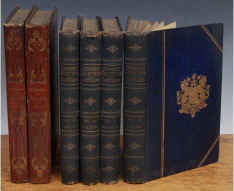
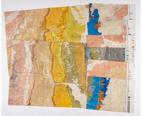
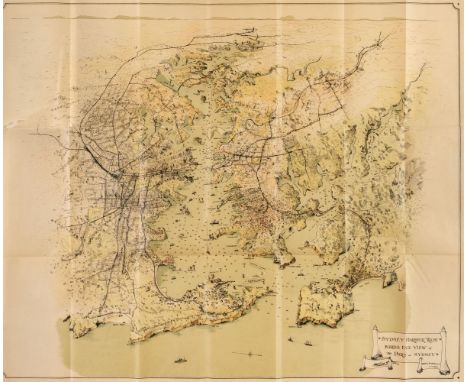
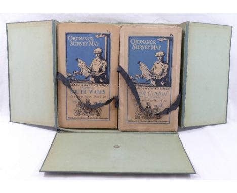
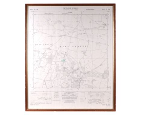
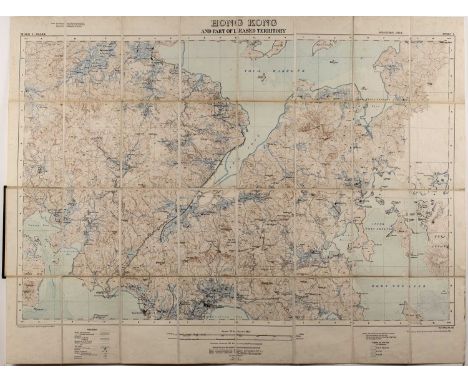
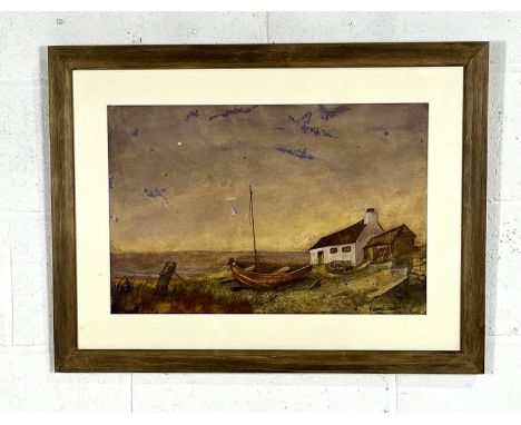
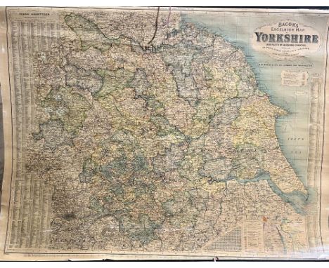
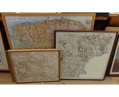
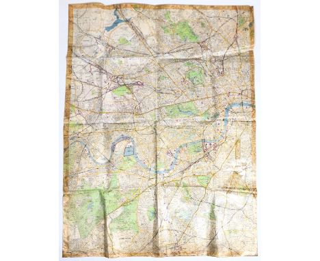
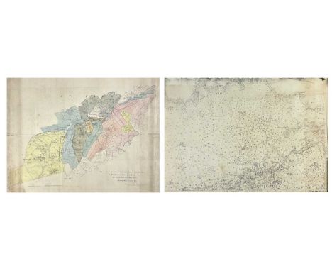
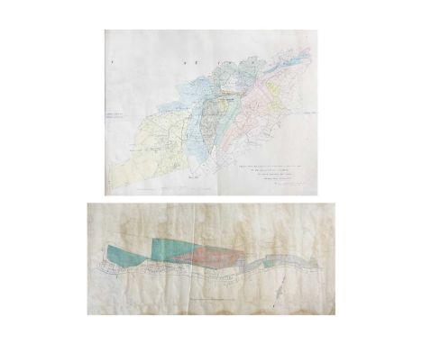
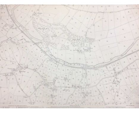
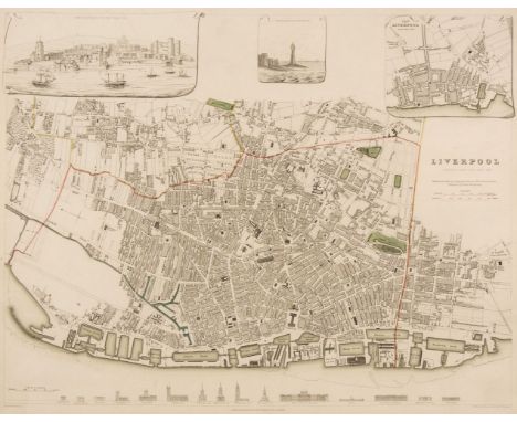
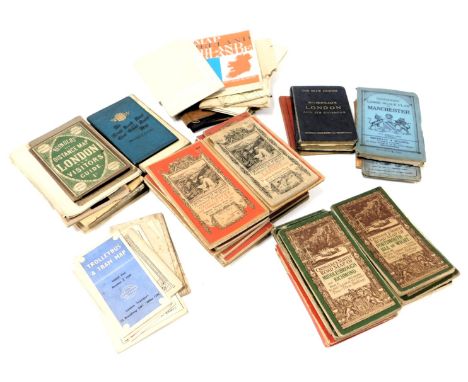
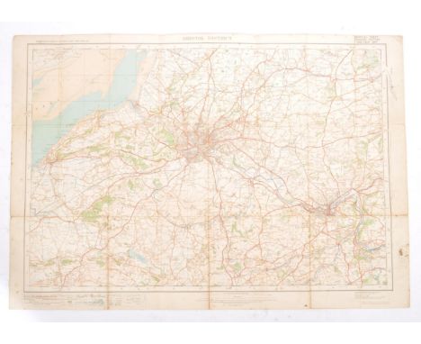
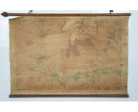
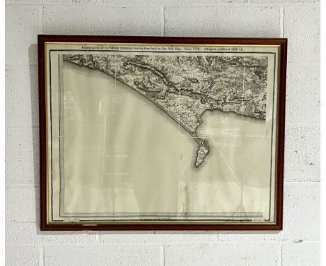
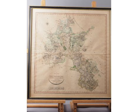
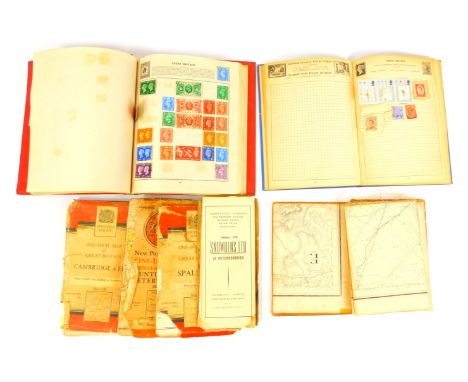
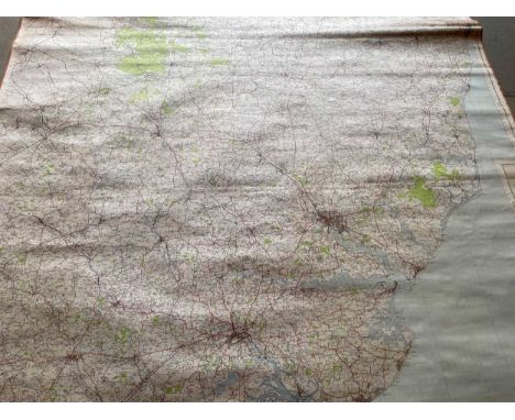
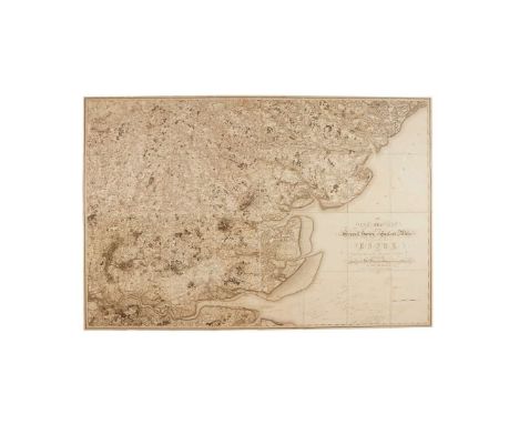
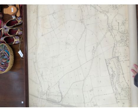
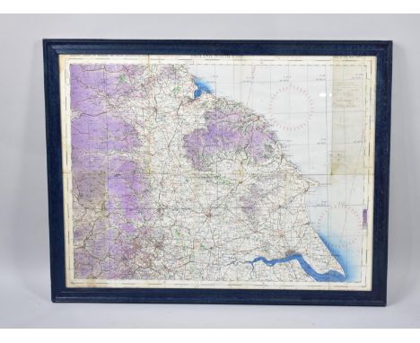
Sydney. Guide to the Port of Sydney N. S. W. published by The Maritime Services Board of N. S. W. printed by D. H. Paisley, Govt. printer, circa 1925, containing five folding maps including Birds Eye View of the Port of Sydney, Sydney Harbour Trust, 1919, colour lithographic pictorial map, printed on thin paper, old folds, short splits where old folds cross, occasional closed tears, 610 x 750 mm, together with Map of the Wharf Accommodation of the Port of Sydney, circa 1920, colour lithographic pictorial map, printed on thin paper, old folds, short splits where old folds cross, torn with the upper left corner of the map detached which remains bound into the volume, with Sydney Harbour Trust, Birds Eye View Showing new Wharfage Scheme Walsh Bay Sydney, circa 1920, colour lithographic pictorial map, printed on thin paper, old folds, short splits where old folds cross, torn with loss, 525 x 810 mm, plus Sydney Harbour Trust Birds-Eye View Showing New Wharfs & Approaches Jones Bay Pyrmont, circa 1920, colour lithographic pictorial map, printed on thin paper, old folds, trimmed to the image along the left hand margin, 470 x 815 mm, and Sydney Harbour Trust Birds-Eye View of Terminal Grain Elevator and Proposed Cargo Berths Glebe Island Port Jackson N. S. W. circa 1920, colour lithographic pictorial map, printed on thin paper, old folds, trimmed to the image along the left hand margin,590 x 815 mm, the volume also contains numerous uncoloured photographic views of the harbour and docks including two folding plates, publisher's green cloth gilt, spine faded, 8vo, together with Paterson (Daniel). Paterson's Twenty-Four Miles round London, with Reference to Seats of the Nobility and Gentry. London, published Bowles and Carver, 25th July 1791, circular engraved map with bright contemporary hand colouring, sectionalised and laid on linen, reference tables to each of the spandrels, very slight spotting, some wear cracks and small holes where old folds cross, crude tape repairs to verso, overall size 660 x 660 mm, contained in a contemporary card slipcase with publisher's printed label to the upper cover and advertisement to the rear cover, worn and frayed with crude tape repairs to the extremities, with Stanford (Edward). A Chart of the World on Mercator's Projection Shewing the Principal Ocean Steam Routes & Submarine Telegraphs &c. Jany. 1st. 1885, large engraved map with contemporary outline colouring, sectionalised and laid on linen, 660 x 1100 mm, contained in a contemporary cloth slipcase with printed title label to the upper cover, plus Hall (Sidney). A Travelling County Atlas..., 1842, printed title, 26 (only) engraved maps with contemporary outline colouring including one folding (Ireland), contents shaken and loose, contemporary 'envelope style' green morocco gilt covers, heavily worn and frayed, with another 10 British and foreign county and regional folding maps, including examples by or after Hughes, Buxey, Ordnance Survey, Bouchard, Allnutt, Vuillemin, Cassell and Colonel Thuillier, various sizes and conditionQTY: (13)NOTE:The Map of London by Paterson. James Howgego. The Printed Maps of London, no.212a. Howgego lists the first edition as 1797. This appears to be an unrecorded state, published six years prior to the first recorded edition.
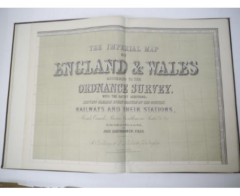
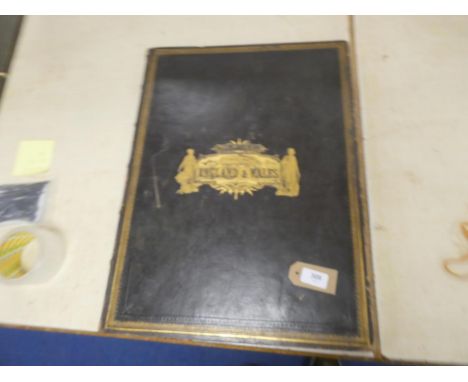
Lot 406

A collection of vintage Ordnance Survey folding maps comprised of  a cased set of 10 maps of Scotland, scale 4 miles to 1 inch, another similar cased set of maps of England,and Wales (maps 2 and 12 lacking), with an additional Midlands map from the same series, published by Colonel Sir Charles Close, a Bartholomew's 'Sussex' map and another 'Kent' and one other folding map of North DartmoorCONDITION REPORTS & PAYMENT DETAILSIMPORTANT * Descriptions do not include condition reports.  Please contact us to if you require further information or images. *  Please consider shipping costs before bidding as this may affect your decision to bid *  Please familiarise yourself with our payment methods.  Our preferred method of payment is by bank transfer.  We do not take cash or card payments.

Lot 34

Local interest: An Ordnance Survey map for East & part of West Knoyle provisional edition sheet ST83SE, 55 by 67cms, framed & glazed.

Lot 676

A large contemporary oversized framed Ordnance Survey map of the City of Bristol. The large map set within acrylic panel clear front and ebonised frameMeasures approx: 114x213cm

Lot 490

A collection of pictures to include AFTER W BEECHEY "Children relieving a beggar boy...", engraved by C Wilkin and published by W Beechey May 1796, 50 cm x 37 cm, AFTER J H DOWD "Young boy with sheepdog", engraving, signed in pencil lower right, 28.5 cm x 20 cm, AFTER P.B HICKLING "Help", colour print, published by Richard Wyman & Co. London, 28 cm x 20 cm, various other watercolours, prints and pictures to include AFTER ARCHIBALD THORBURN and ALBRECHT DURER together with a mounted Ordnance Survey map of North Western Scotland including Island of Mull, Morvern etc (15)

Lot 432

Two sectionalised maps of Hong Kongpublished by the War Office Aug 1905, 71cm x 93cm and a further map published by the War Office Feb.1913 and printed at the Ordnance Survey Office, Southampton, 1913, 75cm x 98cm (2) Provenance:- inherited by the vendor from her grandfather Isaac Day who worked at the University of Hong Kong as an engineering lecturer circa 1918-1938. Some wear and the second map has some discolouring.

Lot 436

Railway Clearing House Official Railway Map of England & Wales 1918, Ordnance Survey England and Wales War Revision 1940 Sheet 65 and Second War Revision

Lot 15

A miscellaneous collection of dissected & linen-backed maps to include three maps of the Midlands, covering parts of Gloucestershire, Worcestershire and Northamptonshire, Sheet Nos. 25, 31 & 32, London: G. & J. Cary, 1832, hand-coloured, each sheet measuring approx. 56.5 x 68.5cm, housed in two slipcases; A New Map of the County of Salop, London: C. Smith, 1818, hand-coloured, housed in slipcase; City of Dublin, Sheet No. 18, Ordnance Survey, 1849, approx. 65 x 98cm; Yorkshire, Sheet Nos. 193 & 194, Ordnance Survey, 1855, each sheet measuring approx. 65.5 x 97.5cm, housed in a slipcase bearing label for 'James Wyld, Geographer to Her Majesty'; Lancashire, Sheet XXI, Ordnance Survey, 1895, approx. 69 x 102cm, and others, including Sussex, Bath & Wells, Wakefield & Pontefract, plus six later maps (17)

Lot 478

Robert Hancock (1730 - 1817), A New and Accurate Plan of the City of Bath to the Present Year 1793, published by W. Taylor and W. Meyler, 1793, hand-coloured engraving, 47 x 53cm, framed and glazed, Bath from the Ordnance Survey, engraved by J. Henshall, coloured engraving, label verso from The Antique Map Shop, Bath, 'Guaranteed to be a genuine antique map, by Henshall, Date c1837', 31.5 x 19cm, framed and glazed, City of Bath, engraving, label verso from Antique Maps, Earley Maps c.1540 - 1900, Certificate of Authenticity, 'Earley Maps guaranteed this to be a genuine Antique Map as dated, by T. Moule, printed in c.1840', 27 x 20cm, framed and glazed, J. Newman, A view from the Railway Arch over Pulteney Road, coloured lithograph, 22 x 31cm, unframed, General Motors Limited advert, colour print, 26 x 9cm, unframed and The Rover Co. Ltd 1948 advert, colour print, 20.5 x 15.5cm, unframed

Lot 755

A framed watercolour "The Slipway" by Karen Charman along with two local interest items. An unframed limited edition 132/250 reproduction print of an antiquarian engraving of the "North View of Lyme Cobb" engraved for the history of Lyme Regis and a framed Ordnance Survey map of Whitford 1887 - 1903 featuring Whitford, Maidenhayne, Hampton, Seaton Branch Line and Seaton Junction etc

Loading...Loading...
  • 1759 item(s)
    /page

Recently Viewed Lots