We found 3951 price guide item(s) matching your search
There are 3951 lots that match your search criteria. Subscribe now to get instant access to the full price guide service.
Click here to subscribe- List
- Grid
-
3951 item(s)/page

Lot 411
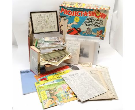
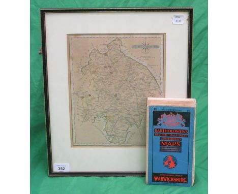
Qty of interesting ephemera etc inc T S Eliot 1941 Burnt Norton & 1942 Little Gidding, Monkey comic by Michael Rosen, 1933 The dance of death by W H Auden, Stuart models, autograph book, framed Barnstaple to Truro road map etc t/w boxed Bell's battery operated Project-a-show (appears complete but will need a battery!)
Lot 133
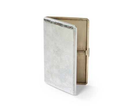
A silver plated 'London maps' cigarette case. c.1935Of rectangular form, the front cover engraved with a road map of greater London from Boreham Wood to Biggin Hill and Ealing to Woolwich, the back with central London postal areas (such as WC1, EC2, N5, etc) against an engine turned ground, the inside engraved with a London Underground map and designed with two compartments for cigarettes, 9 x 13.9cm Footnotes: The approximate dating of this cigarette case is based on the tube map on the inside of the cover - no York Road' Station, between Caledonian Road and Kings Cross Stations, it was closed in 1932 - and the map has 'Mark Lane' station next to Monument which was renamed Tower Hill in 1946.
Lot 1141
Five Maps - John Owen and Emanuel Bowen, finely engraved antique map from the atlas "Britannia Depicta", THE SMALLER ISLANDS IN THE BRITISH OCEAN, first published by John Owen and Enmanuel Bowen, together with Owen and Bowen 'The Road from Oxford to Chichester', and three Channel Island maps. (5)
Lot 414
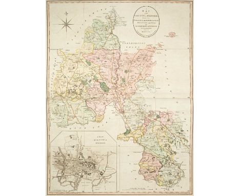
Davis (Richard) A New Map of the County of Oxford from an Actual Survey; on which are Delineated the Course of the Rivers and Roads, the Parks, Gentlemen's Seats, Heaths, Woods, Forests, Commons &c. &c., London: John Cary, 1797, key map of Oxfordshire with original hand colouring and inset b & w town plan of Oxford, seventeen map sheets (including title page) all with original hand colouring, each plate approximately 49cm x 67cm, rebound in a modern large folio (58cm x 41cm) in half calf with marbled boards and red morocco title label, new endpapers, pencil booksellers notation to front pastedown with pasted blind stamped bookplate and signature 'H. George Fordham, Odsey, 1918'A private collection. Previously Sir Herbert George Fordham (1854–1929), a writer on cartography whose Carto-Bibliography method of cataloguing maps was widely adopted. He attended University College, London. He was the benefactor of the Fordham collection housed by the Royal Geographical Society. He received a knighthood in 1908 and from 1920 was Deputy Lieutenant of Cambridgeshire. He donated rare maps and atlases to both the British Museum and to Cambridge University Library and he bequeathed 1300 volumes, including rare road books and itineraries, to the Royal Geographical Society. His house, 66 Odsey House, was built as a racing lodge close to Odsey racecourse by the Duke of Devonshire, and had been in the hands of the Fordham family since 1793This detailed and accurate map of Oxfordshire with its fine town plan of Oxford is Davis’s only contribution to English cartography, although he was a prolific surveyor of estates in and around Oxfordshire. Surveyed on a scale of 2 inches to 1 mile this map is widely regarded as an important land mark in large scale cartography. Brian Kentish. Large Scale County maps of England and Wales 1705-1832, no.45
Lot 173
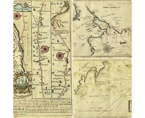
LEWIS MORRIS (1701-1765) two engraved maps, published 1748, 'A Plan of Dulas Bay & Harbour in North of Anglesey', and 'Kemlyn Bay & Harbour in North of Anglesey', 18.5 x 24cms, with hand-coloured engraved map of the road from Beaumaris to Holyhead, 18.5 x 12cms (3)Provenance: private collection Ynys MônComments: all framed and glazed
Lot 916
SEVEN BOXES AND LOOSE CERAMICS, GLASSWARE, AND BOOKS, a selection of drinking glasses, vases, bowls and decanters, names include Dartington crystal and Edinburgh crystal, selection of table lamps included a vintage brass bankers lamp, (no lamps are tested), a framed road map titled 'Road from Wick to Thurso' plate 25 also in the back of the frame also covered with glass a map titled 'Road from Perth to Fort George' plate 26, a selection of framed prints various scenery, a pair of oriental urns decorated with the art of Chokin, small bud vases, cups and saucers etc. over one hundred titles mostly hardback format, subjects include planes, motorbikes, places etc. (7 boxes + loose), (sd/af)
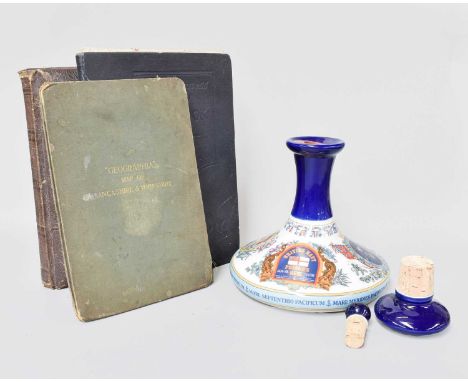
Lot 75
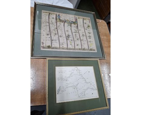
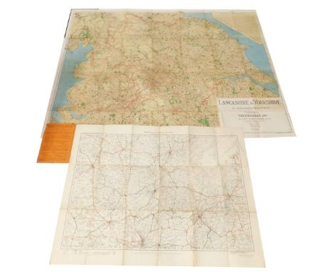
A Boxed Pussers Rum Nelsons Ships Decanter, together with a Victorian photograph album (lacking contents), Geographia map of Lancashire and Yorkshire, Daily Express road book of Great Britain , together with M C Lamb (late 19th/early 20th Century)Figure on a country pathwaySigned and dated 1920, watercolour, 26cm by 36cm; together with a further watercolour by the same on a similar theme (qty)
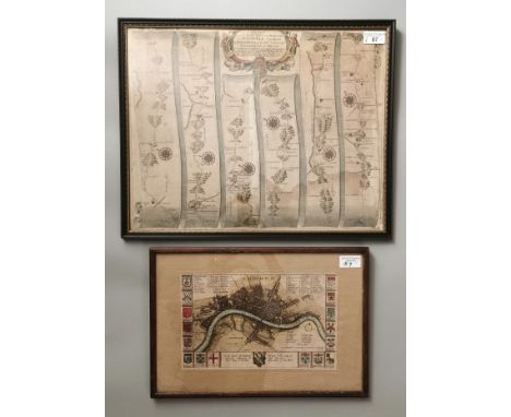
Lot 87
John Ogilby (British 1600-1675), original strip road map 'The Road from St David's in Pembrokeshire to Holywell in Flint'. (Talybont). Later coloured. 36x46cm approx. In glazed Hogarth frame. together with Richard Blome (1641-1705), small original map of London, later coloured with coats of arms to the border. (2) (B.P. 21% + VAT). The Ogilby map has some discolouration to is lower parts and the Blome map has been cropped and stuck down. The Blome measures 17.5x28cm approx. and is stuck down as afore mentioned.

Lot 109
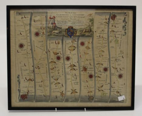
This is a copperplate engraving from Britannia, Volume the First: An Illustration of the Kingdom of England and Dominion of Wales, published by John Ogilby in 1675. It depicts the continuation of the road from London to Lands End, illustrating the major roads and important locations along the way. Ogilby’s work was revolutionary in providing detailed road maps for travelers, and this map represents one of the earliest British road atlases, a pioneering work in cartography. The map features a detailed depiction of the road from London to the southwestern tip of England, highlighting towns, landmarks, and distances in a unique manner. The use of mile markers, town names, and scenic views helps convey the importance of this travel route during the 17th century. Condition: Signs of wear, with some damage to the centre folds due to the age of the map. The engraving itself is clear and detailed, with some light creases and edge wear typical of maps of this period. Size of Image: 32 x 44 cm (approximately 12.5 x 17.3 inches). Keywords: John Ogilby, Britannia, road maps, British road atlas, cartography, historical maps, London to Lands End, 17th-century map, geography, British travel, English roads, vintage map, historical cartography, 1675, English maps.
Lot 41
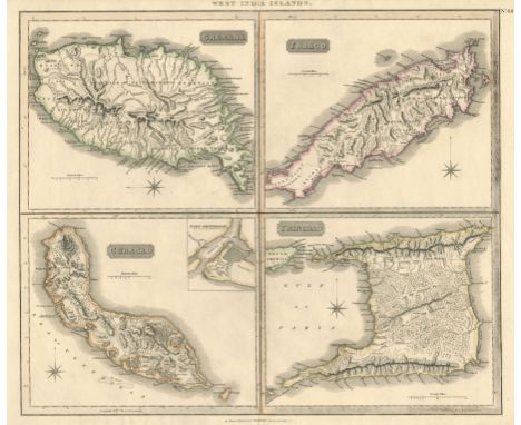
This detailed map, drawn and engraved for Thomson's New General Atlas, depicts the West India Islands, including Grenada, Tobago, Curacao, and Trinidad. The map is rich in detail, showcasing roads, landscapes, and port views, providing a vivid insight into the geographical features and infrastructure of the islands during the early 19th century under British control at the end of the Napoleonic War. Cartographer: John Thomson Date: 1816-21. paper watermarked 1821. Published: Edinburgh Original colour. Condition Report: Signs of wear. Image Size: 52 x 59 cm (20.5 x 23.2 inches) Keywords: West India Islands, Grenada, Tobago, Curacao, Trinidad, Thomson’s New General Atlas, early 19th-century maps, uncoloured map, road networks, landscapes, port views, Caribbean maps, Edinburgh.
Lot 467
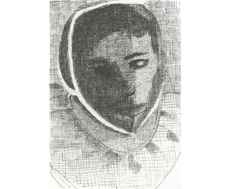
Sara Berman Fencer Pen Study II, 2024 Pen on paper Signed on Verso 10 x 15cm (3¾ x 5¾ in.) About b. 1975, London; lives and works in London. A dialogue between painting and textiles. Feeding into each other, joining at the seams, meeting in uncomfortable places. There is a bleed in my work; a contamination. I can attempt a sanitization, a cleaning up of the domestic detritus into a cupboard marked 'Practice' but the bleed is the point, the uncomfortable nooks of the female bodily experience. This is the issue. Pass me a tissue so I can clean it all up for you and put something on. Clothing as objects of confinement, of protection, of identity, of safety. Inside. Outside. Painting is a game of materiality. The visceral qualities of paint. Layered, built up, scraped back and bruised. Emerging from violence of its own making. Searching. It is important to start any search with a map of the road to nowhere. My map is The Harlequin. An outfit, a costume The perfect disguise. The perfect reveal. It all starts with her. The Harlequin as a Woman is No Joker. She is the Trickster Whore. The Witch, the Shrew, the Sorceress with the voice of a Harpy. Fear her with her big mouth, her bloody gash. But I digress, I transgress. Me and My Big Mouth. Education 1995-1999 Saint Martins School of Art and Design, London 2014-2016 MFA Slade School of Art, London You must not reproduce, duplicate, copy, sell, resell or exploit any works. In doing so, you endanger our relationships with artists and directly jeopardise the charitable work we do.

Lot 466
Sara Berman Fencer Pen Study I, 2024 Pen on paper Signed on Verso 10 x 15cm (3¾ x 5¾ in.) About b. 1975, London; lives and works in London. A dialogue between painting and textiles. Feeding into each other, joining at the seams, meeting in uncomfortable places. There is a bleed in my work; a contamination. I can attempt a sanitization, a cleaning up of the domestic detritus into a cupboard marked 'Practice' but the bleed is the point, the uncomfortable nooks of the female bodily experience. This is the issue. Pass me a tissue so I can clean it all up for you and put something on. Clothing as objects of confinement, of protection, of identity, of safety. Inside. Outside. Painting is a game of materiality. The visceral qualities of paint. Layered, built up, scraped back and bruised. Emerging from violence of its own making. Searching. It is important to start any search with a map of the road to nowhere. My map is The Harlequin. An outfit, a costume The perfect disguise. The perfect reveal. It all starts with her. The Harlequin as a Woman is No Joker. She is the Trickster Whore. The Witch, the Shrew, the Sorceress with the voice of a Harpy. Fear her with her big mouth, her bloody gash. But I digress, I transgress. Me and My Big Mouth. Education 1995-1999 Saint Martins School of Art and Design, London 2014-2016 MFA Slade School of Art, London You must not reproduce, duplicate, copy, sell, resell or exploit any works. In doing so, you endanger our relationships with artists and directly jeopardise the charitable work we do.
![India.- Siege of Delhi.- Anonymous (active 1850s) Map of Delhi and the Neighbourhood, inscribed 'For General B. V. [?]Darving](https://cdn.globalauctionplatform.com/8c3b0654-f508-46cc-a759-b29101151ad5/9aa64503-bc6e-4278-83e7-b29101180085/468x382.jpg)
Lot 119
India.- Siege of Delhi.- Anonymous (active 1850s) Map of Delhi and the Neighbourhood, inscribed 'For General B. V. [?]Darvingy/ With Mrs Hughes Kind regards' in the upper left, and further inscribed along the lower edge '...This map will enable you to follow the movements of our troops & understand the Newspaper accounts. 14th July 1857. The remainder of the [?] 86th Regt. marched past my house at 7 am to proceed, by rail, to [?] 10,000 insurgents on the road to B[om]bay!!', lithograph, on thin wove paper without watermarks, 330 x 480 mm (13 x 18 7/8 in), old folds and handling creases, light surface abrasion and finger-soiling, unframed, [1850s]
Lot 477
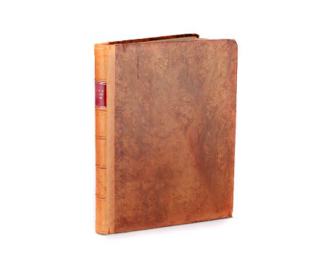
John Cary, Cary's New and Correct English Atlas, 1793John Cary, Cary's New and Correct English Atlas: Being a New Set of County Maps from Actual Surveys..., printed for John Cary, Engraver, Map and Print-seller, No.181 near Norfolk Street, Strand, published as the act directs Jan 1st 1793, large Quarto, full leather period boards, recent spine and binding replaced end papersJohn Cary (c. 1754–1835) was a prominent English cartographer, engraver, and globe-maker, celebrated for the precision and artistry of his maps. Renowned for his attention to detail, Cary played a significant role in elevating cartography to both an art form and a practical science. His surveys and innovative methods earned him commissions from various government bodies, including the Ordnance Survey, where he worked to establish accurate baselines for mapping.Cary's atlases, globes, and road maps became essential tools for travelers, geographers, and planners during the late 18th and early 19th centuries. His New and Correct English Atlas is considered a landmark in British cartography, influencing the way maps were designed and utilized. Cary’s commitment to accuracy and clarity set new standards for the field, ensuring his legacy as one of England’s finest mapmakers.Book Description: The 1793 edition of Cary's New and Correct English Atlas is a carefully revised and expanded version of the original 1787 publication. This second edition reflects John Cary’s dedication to precision and includes updated maps based on actual surveys. Featuring a complete set of English county maps, the atlas is accompanied by descriptive text, providing geographical, demographic, and historical insights for each county.The maps are finely engraved and hand-colored, showcasing Cary’s mastery in combining scientific accuracy with aesthetic appeal. The second edition incorporates corrections and enhancements to the original plates, reflecting the evolving understanding of England’s geography in the late 18th century. Cary’s clear and detailed cartographic style made this atlas an indispensable tool for planners, travelers, and scholars of the era.This 1793 edition offers a rare glimpse into Georgian England’s geography
Lot 164
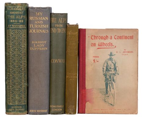
Travel. Whymper (Edward), Scrambles Amongst The Alps in the Years 1860-69, first edition, London: John Murray, 1871, half-title, illustrated with 23 full-page plates and 5 folding maps as called for, in-text illustrations, some splits within the block but holding, original publisher's green cloth gilt over slightly bevelled boards, some wear, 4to; Cycling: Jefferson (Robert L.) & Evans (Harry, illustrator), Through a Continent on Wheels, only edition, London: Published by Simpkin, Marshall, Hamilton, Kent & Co., Ltd., Leicester: Printed by W. Watts, [1898], illustrated, pictorial and other adverts, original cloth over pictorial boards, 8vo; Wenyon (Charles), Across Siberia on the Great Post-Road, first edition, London: Charles H. Kelly, 1896, folding map, plates and in-text illustrations, lacking ffep, original publisher's cloth, 8vo; Dufferin and Ava (The Dowager Marchioness of), My Russian and Turkish Journals, first edition, London: John Murray, 1916, plates, original publisher's cloth, 8vo; Conway's Alps, 1905, plates, original cloth, 8vo, (5)

Lot 75
Registration – YJ63 CYEChassis No. – WBS6C92030DV74225M.O.T. – September 2025Odometer – 63,000When the BMW M6 Gran Coupe was launched in 2012 it vied with the i8 as BMW’s most expensive model. In Gran Coupe mode the M6 is a fire breathing “four door coupe” with unmatched luxury and cachet. ‘YJ63 CYE’ garnishes that already exquisite recipe with a Stage 1 map bringing power up to a mighty 681bhp (readout provided). Offered here with no reserve, ‘YJ63 CYE’ is complete with a full BMW service history, four new tyres and new pads and discs throughout. With around 63,000 miles covered to date ‘YJ63 CYE’s’ exhibits significantly below average use in the hands of five former keepers. Complete with a valid MOT until September 2025, this is your rare chance to own a rang topping BMW with a huge 681bhp on tap.With the M6 Gran Coupe BMW pulled off the seemingly impossible. As Evo noted at its launch in 2012, it looks both sleeker than an M5 and cooler than the M6 Coupe. Praise indeed! ‘YJ63 CYE’ certainly validates that view in its stealthy Singapore Grey metallic livery with carbon fibre roof panel and chunky quad exhausts. Furthermore, ‘YJ63 CYE’ sits purposefully on a set of 20-inch BMW 433M alloys with diamond cut faces and black accents. The sumptuously appointed and fastidiously engineered four seater cabin is finished in Opal White Merino leather with carbon fibre accents. Given this car’s status in the model line up and nearly £100,000 original ticket price, it features every refinement that 2013 could muster. These include four zone climate control, electrically controlled and heated seats with memory function, wide-screen BMW Professional audio and satellite navigation system and heads up display. The vendor reports the paint and bodywork as “good” and the interior as “excellent.”As with all models carrying the revered M-Sport prefix, it is ‘YJ63 CYE’s’ mechanical specification that is likely to set the purists’ hearts a-flutter, however. The heart of this beast is the S63 4.4-litre twin turbo V8 that was shared with the M5. Power is distributed via a seven-speed M Double Clutch Transmission with DRIVELOGIC. The advanced Active M differential shuffles torque across the rear axle to the prioritise the wheel with the most grip. Variable damper control optimises road dynamics in real time. In addition to all that, ‘YJ63 CYE’ enjoys a significant power boost courtesy of that Stage 1 map. No wonder the vendor confirms that “it goes like a rocket” and judges all mechanical systems as “excellent.”

Lot 76
Registration – RS63 BBBChassis No. – WUAZZZF27NN900501M.O.T. – September 2025Odometer – 37,600Whilst the Audi RS6 sits at the top of the A6 model lineage, the Carbon Vorsprung is the ultimate offering in the RS6 range. With the “standard” RS6 Avant Carbon Vorsprung already having a retail price today of a shade under £135,000, ‘RS63 BBB’ raises the bar still further with a raft of performance upgrades and valuable extras. These comprise a Stage 2 map, a Milltek de-cat full exhaust system and Wagner performance intercoolers and air intake. The original factory hardware is also included in the sale. These enhancements are reported to take ‘RS63 BBB’s’ power output to over 800bhp and its torque to around 1200 NM. True supercar vanquishing territory! What’s more ‘RS63 BBB’ is a one owner car having covered a mere 37,600 miles to date. An example of the current C8 RS6 model, ‘RS63 BBB’ features the optional Carbon Styling Pack worth many thousands as well as the myriad of standard equipment deemed worthy of the range topping RS6.The C8 version of the Audi A6 arrived in 2019 and remains current today. The RS6 version joined the range, as usual, to become one of the fastest and most capable “cars for all seasons” that it is possible to buy. The RS6 features a 4.0L Twin-Turbo V8 feeding power to all four wheels via Audi’s 8-Speed automatic gearbox. In a non-modified form this configuration is good for a sub four second 0-60mph time and an electronically limited top speed of over 170mph. And all this whist carrying a chest of drawers in the back, should you so choose. ‘RS63 BBB,’ of course, benefits from performance enhancements that will improve on those figures still further.‘RS63 BBB’ presents in Daytona Grey matt effect, another expensive option. This combined with the various carbon fibre accoutrements of that Carbon Styling Pack give ‘RS63 BBB’ a mountain of road presence and more than a little brooding menace. A set of Vossen HF2 alloy wheels in anodised bronze are fitted to add the aesthetic shock and awe as well as to the growing list of expensive extras present. The capacious cabin is exquisitely trimmed in black Valcona leather with a honeycomb quilted design and accompanying RS6 embossing. The level of factory equipment included is extensive, of course. Highlights include a panoramic sunroof, heated front and rear seats, adaptive cruise control and power-assisted door closers. There's also RS Sport Suspension Plus with dynamic ride control. Given ‘RS63 BBB’s’ one owner, low mileage provenance all aspects of the car are vendor rated as “excellent.”In summary:· A superb example current Audi RS6 model in range topping Carbon Vorsprung spec.· Further enhanced by way of high-specification, high-value performance upgrades· A single owner car with a very sensible original mileage and model specific registration plate
Lot 56
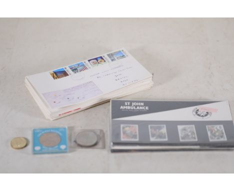
Collection of Philatelic and Numismatic MemorabiliaThis collection comprises diverse philatelic and numismatic items, suited for collectors:1. **First Day Cover: "British Architects in Europe" (1987)** - Standard envelope with "BRITISH ARCHITECTS IN EUROPE" and a map design depicting pre-reunification Germany. - Features five 18p stamps of architectural landmarks, postmarked "CLEVELAND, 12 MAY 1987." - Addressed to "Master Simon Jenkinson, 80 Cranleigh Court Road, Yate, Bristol, Avon, BS 175 DL."2. **Royal Mail Mint Stamp Packs** - Themes include "St John Ambulance," "Arthurian Legend," "Christmas 1987 & 1988," "Royal Air Force," and "A Celebration of Anniversaries," among others. - Packs sealed in plastic, featuring detailed artwork and thematic mint stamps from late 1980s to early 1990s.3. **Coins and Commemorative Medals** - **£2 Coin Featuring Queen Elizabeth II**: Inscribed with "ELIZABETH II · DEI GRATIA REGINA F·D· TWO POUNDS." Likely from late 20th-century circulation or commemorative minting. - **Queen Elizabeth The Queen Mother Medallion**: Inscribed "QUEEN ELIZABETH THE QUEEN MOTHER AUGUST 4th 1980," commemorating her 80th birthday, with heraldic motifs around the edge. Diameter approx. 40–45 mm. - **1981 Royal Wedding Commemorative Coin**: Celebrating the marriage of H.R.H. The Prince of Wales and Lady Diana Spencer, packaged by Barclays Bank with a blue presentation card. - **1986 Scottish Thistle Coin**: Bearing a central thistle motif surrounded by laurel leaves; marked "1986" at the top, potentially a commemorative piece for Scotland.This collection highlights philatelic items commemorating significant events, architectural themes, and Royal Mail issues, alongside numismatic coins celebrating British royalty and historical milestones from the late 20th century.
Lot 32
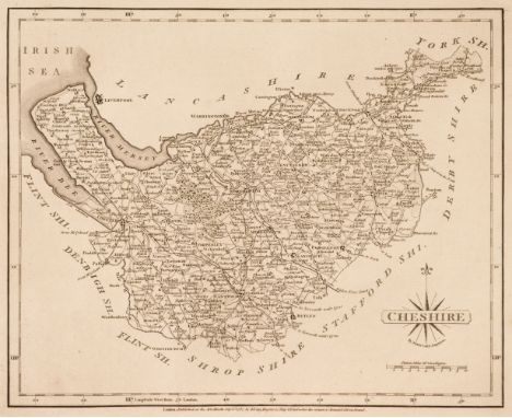
Cary (John). Cary's New and Correct English Atlas; Being a New Set of County Maps from Actual Surveys..., 1st edition, Sept. 1st 1787, frontispiece of an advertisement, calligraphic title with near-contemporary ownership signature and some dust soiling, dedication, list of subscribers and contents list, the contents with ink annotations, 47 (complete as list) uncoloured engraved maps, each with a tissue guard and a sheet of descriptive text, each map with a contemporary manuscript number to the verso, slight spotting but largely confined to the tissue guards, table of road junctions bound at rear, later endpapers, uncut, modern half calf with gilt decorated spine, 4toQTY: (1)NOTE:Chubb CCLX. First edition of Cary's earliest published atlas.
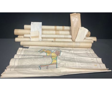
Lot 385
Cartography & Town Planning – An incomplete set of maps of Nottingham drawn up to illustrate the Corporation’s Draft Town Planning Scheme 1931 under T. Wallis Gordon, City Engineer 9in : 1 mile, District I map 2, District 2 Map 2 District 3 Map 2 (two copies), District 4 Map 2 District 5 Map 2 also Map No. 3 (no district named) (Qty); a road widening map of part of Cotgrave dated 1936 with accompanying letter from Nottingham County Council giving notice to the Home Pierrepont estate; further correspondence concerning the same and a large plan 49 x 21in. similar to the above (qty)
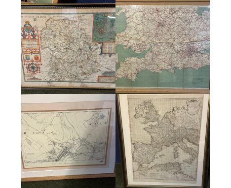
Lot 575
Four framed and glazed maps to include: Two large framed and glazed maps: The Bacons Motor Road Map of England and Wales (crack to class in top right corner, double sided with London on one side) ; And a map of Europe Orbis Romani Pars Occidentalis etc; and a modern map of Marlborough from the 1899; and a map of Shropshire hire with some wear and annotations; and a wall mirror
Lot 182
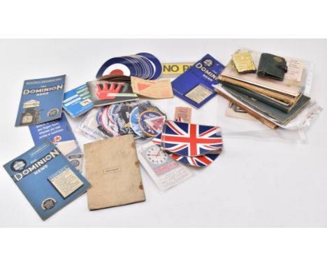
Automobilia Interest - a collection of 20th century autombillia ephemera largely to include motor manuals and maps. To include illustrated car instruction manuals for Citroen Twelve, Morris-Cowley and a 1929 Rover. The maps to icnlude a picture map of london, a Regent Super road map, MEX Motor Spirit map of the River Thames, Pratts road atlas of England and Wales. Also to include a collection of Shell ephemera to include avertising, a motor oil multiguide, an embossed Shell card case, Shell abridge lubricants handbook. Alongside an assorted collection of ephemera to include bumper stickers, Amstrong Siddeley Filtrate oils booklet, The Dominion News pamphlets, a motor fuel ration book and a collection of applique and metal badges.
Lot 325
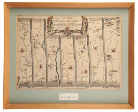
JOHN OGILBY 'THE ROADS FROM EXETER TO DORCHESTER AND PLYMOUTH TO DARTMOUTH' hand coloured strip road map, taken from 'Brittannia...Description of the Principal Roads thereof', 1698 edition, 32.5cm x 46cm; together with a small John Cary map of Dorsetshire, 23cm x 27.5cm (2)Provenance: The Collection of Roy and Anita Fursey. Both scientists, Roy and Anita Fursey were avid collectors of all things Dorset and built their home, Tollys Orchard in Netherbury
![[MAP]. SOMERSET & DEVON Ogilby, John (Scottish, 1600-1676). 'The Road from Bristol to Exeter', engraved ribbon map, hand](https://cdn.globalauctionplatform.com/5e610135-63b4-4651-87c4-b2480116f215/5c74e6cd-cf24-4f03-b077-b28b011472bd/468x382.jpg)
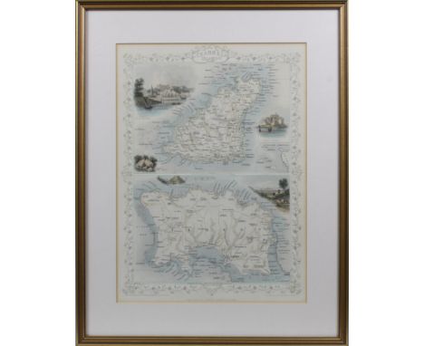
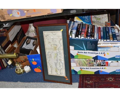
Lot 242
[MAP]. SOMERSET & DEVON Ogilby, John (Scottish, 1600-1676). 'The Road from Bristol to Exeter', engraved ribbon map, hand-coloured, 35cm x 45cm, framed and glazed. Condition Report : Generally good condition; evenly browned; not laid down; no obvious tears, repairs, or holes. Condition reports are offered as a guide only and we highly recommend inspecting (where possible) any lot to satisfy yourself as to its condition.
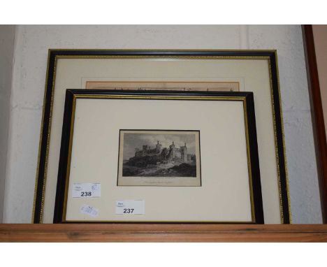
![[MAPS]. SOMERSET & DEVON Gardner, Thomas (English, 1690-1769). 'Continuation of the Road from London to Barnstable [Barn](https://cdn.globalauctionplatform.com/5e610135-63b4-4651-87c4-b2480116f215/be651009-a0d4-4b58-9c2e-b28b01154530/468x382.jpg)
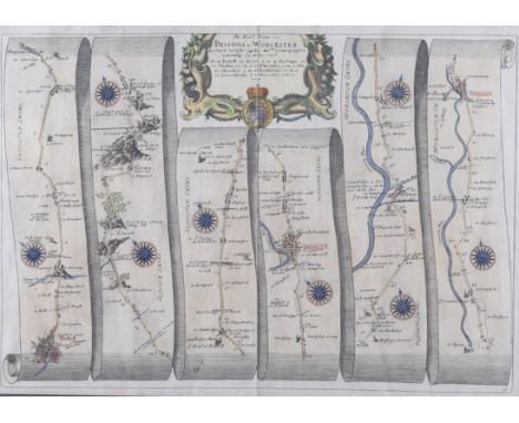
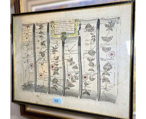
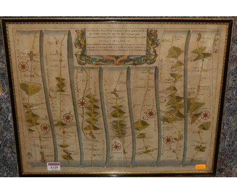
Lot 247
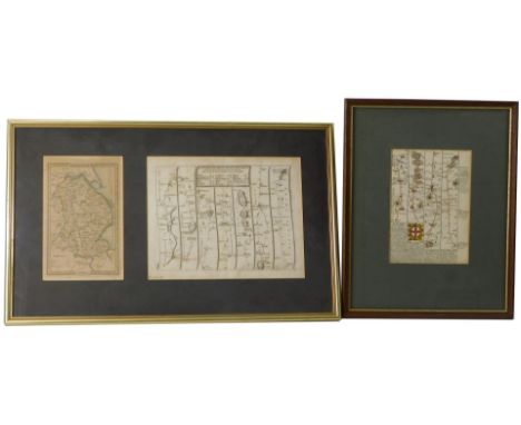
[MAPS]. SOMERSET & DEVON Gardner, Thomas (English, 1690-1769). 'Continuation of the Road from London to Barnstable [Barnstaple]' (Bridgwater to Barnstaple and Hatherley section), engraved ribbon map, hand-coloured, 18cm x 28cm, framed and glazed; together with Bowen, Emanuel (English, c.1694-1767), and Owen, John. The Road from Maiden Bradley to Bruton and Bridgwater and [verso] The Road from Bridgwater to Williton and Dulverton, engraved strip map, hand-coloured, 19cm x 12.5cm, framed and glazed, in a double-sided frame, (2). Condition Report : Gardner: Generally good condition; evenly browned; not laid down; no obvious tears, repairs or holes; Bowen: Generaly good condition; fresh, understated colours; not laid down; no obvious tears, repairs, or holes. Condition reports are offered as a guide only and we highly recommend inspecting (where possible) any lot to satisfy yourself as to its condition.
![[MAP]. SOMERSET & DEVON Ogilby, John (Scottish, 1600-1676). 'The Road from London to Barstable [Barnstaple]' (Bridgwater](https://cdn.globalauctionplatform.com/5e610135-63b4-4651-87c4-b2480116f215/61c0b772-a7c9-4f26-856e-b28b01147346/468x382.jpg)
Lot 241
[MAP]. SOMERSET & DEVON Ogilby, John (Scottish, 1600-1676). 'The Road from London to Barstable [Barnstaple]' (Bridgwater to Barnstaple and Hatherley section), engraved ribbon map, hand-coloured, 33cm x 46cm, framed and glazed. Condition Report : Generally good condition; evenly browned; not laid down; no obvious tears, repairs, or holes. Condition reports are offered as a guide only and we highly recommend inspecting (where possible) any lot to satisfy yourself as to its condition.
Lot 348
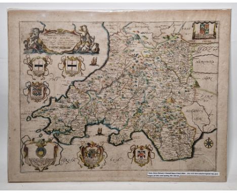
Richard Blome (1660-1705) 'A Generall Mapp (sic) of South Wales wherein are the Countyes of Glamorgan, Carmardan, Pembrock , Cardigan, Brecknock, Radnor, c.1673, hand-coloured engraved map, decorated with six heraldic coats of arms, decorative cartouche, unframed, 40cm x 51cm, together with a Thomas Gardner hand-coloured engraved strip map '"The Road from St. David's to Holywell" "From Talabont to Machenlett to Aberangel to Bala to Ruthyn to Holywell", plate 67 in "Pocket Guide to The English Traveller" published by Thomas Gardner in 1719, unframed, 20cm x 28cm and Emanuel Bowen (Fl. circa 1750) hand-coloured engraved map of Carnarvanshire (sic) c.1720, with strip map and text verso, framed and glazed, mount aperture 19cm x 12.5cm (3)

Lot 354
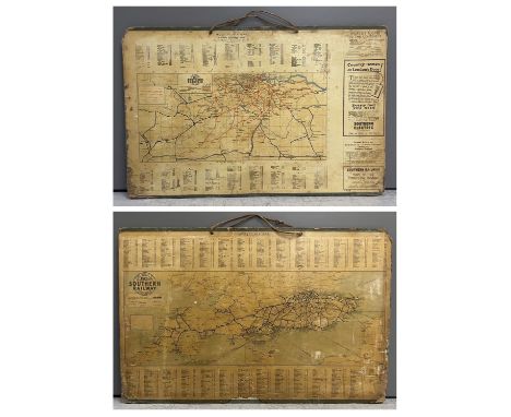
Double sided Southern Railway Maps from 1928 featuring on one side the London and suburban districts. Also detailed is the Proposed new light railway from Sanderstead via Chelsham, Tatsfield to Orpington. On the other side the map details The Road to Sunshine. Maps varnished and mounted on hardboard, in as used condition, with wear around the edges commensurate with age.
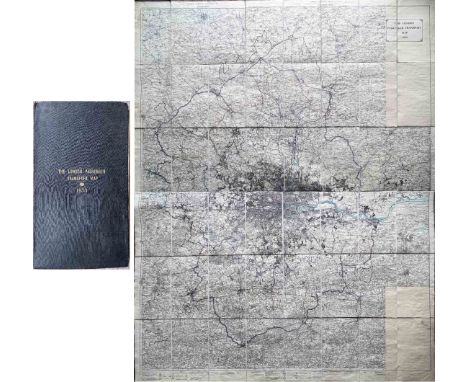
Lot 41
1933 LONDON PASSENGER TRANSPORT MAP of the area under the control of the new LPTB (London Transport) showing the boundaries of the LPT, London and Metropolitan Traffic Areas, Metropolitan Police District, roads available to the Board without and with restriction, roads available to other road services, railways, City of London and County boundaries etc. Bears the stamp of the LNER Coaching Audit Office on the reverse. Linen-backed inside leathercloth, hard covers, opens out to 67.5" x 86.5" (172cm x 220cm) and is in very good condition. [1]
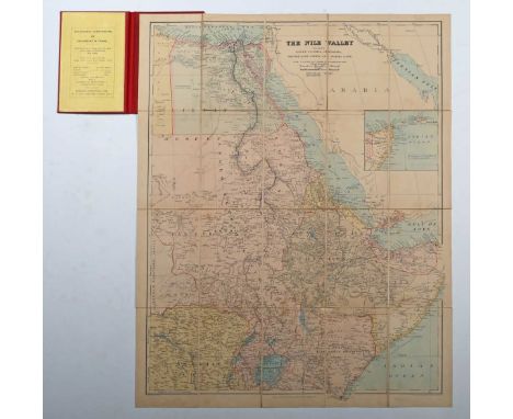
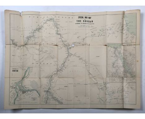
Lot 44
John Bartholomew’s Special Large Scale War Map of The Soudan, extending to Suakim on the Red Sea, 1885, folding map, 57cm x 78cm, together with Gold Coast Survey Department, Road Map (Northern Section) of the Gold Coast 1949; John Bartholomew & Son, Central & East Africa x2; and further maps of the Belgian Congo (5).
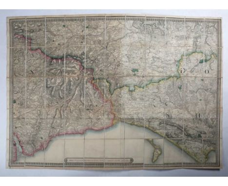
Lot 22
James Wyld – Country round Lyme Regis 1837, folding engraved map with hand colouring in 55 sections, linen backed, 93.5cm x 126.5cm, in its case, together with Bacon’s County Map of Suffolk; Daily Mail Motor Road Map of South East England; Philips' Cyclists' Map of the County of Sussex; Philips' Tourist Map of N & S Wales; Keen’s New Shilling Map of the Watering Places of Kent; Walker’s Suffolk; A New Map of the County of Essex divided into Hundreds by Nathaniel Coltman; Geological Sheets 341 & 342 Weymouth/Portland; and six Sifton Praed folding maps of areas around Devizes (15).
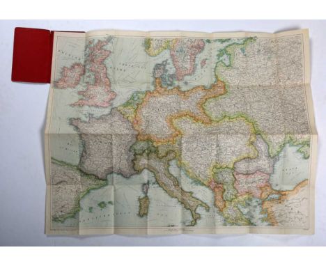
Lot 47
Folding maps: including Bacon’s War Map of Europe; New Orleans, Louisiana A City Map; Bacon’s New War Map of South Central Europe; War Map No. 7, Large Scale Map of the Balkan States; Stanford’s General Map of the United States; Latest Road Map and Guide to Delhi Old & New; E. Andriveau-Goujon, 2 Angleterre, depicting the mid-section of England and Wales, folding map, engraving with hand colouring, sectionalised into 33, 71.5cm x 174cm, and assorted tourist and political maps (box).
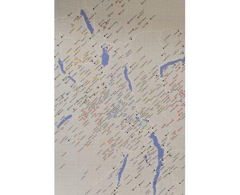
Lot 74
214 Wainwright Fells and the tarns of the Lake District Wall Map, designed by Ian Shackleton in memory of Howard Shackleton 2014, depicting all of Wainwrights 214 Lakeland Fells, over two hundred Lakeland Tarns, twenty-three Youth Hostels, the road networks and towns and villages of the area.Each fell and tarn is grid referenced and colour coded to correspond with Wainwright's Pictorial Guides, all fells are listed in height order in both feet and metres. unframed, housed an a cardboard tube.
Lot 455
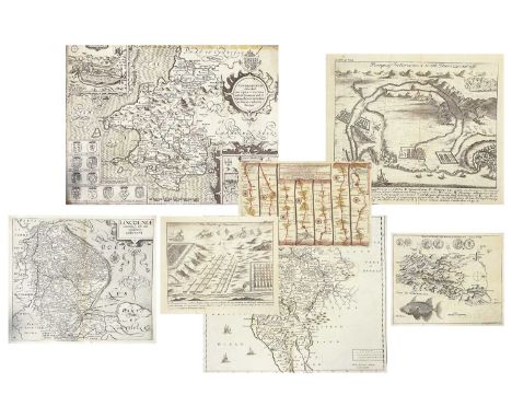
A collection of 17th and 18th century copper engraved maps Nineteen Robert Morden. 'Cumberland,' uncoloured copper engraved map, centre fold, vg, 36.5cm x 43.5cm, sold by Abel Swale Awnfham & John Churchill; John Ogilby. 'The Continuation of the Road from London to the Lands End,' coloured copper engraved line map, pasted to mount measuring 29cm x 39cm; John Speed. 'Penbrookshyre described,' uncoloured copper engraved map, rolled with tape marks and nibbles, fair to good, 38cm x 55cm; William Kip after Christopher Saxton. 'Lincolniae,' uncoloured copper engraved map, rolled, tears to margin, good; With fifteen other maps and engraved plates. (19)
Lot 205
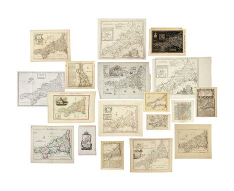
(Cornwall) A fine collection of (mostly) scarce maps Richard Blome. 'A Table of the Hundreds in the County of Cornwall,' uncoloured engraved map, centre fold, engraved view of Pentillie Castle (page 54 in Quixley & Quixley for an interesting history of James Tillie), small nibbles to edges of leaf measuring 23xm x 33cm, [published in Cosmography and Geography, Samuel Roycroft, 1693]; Louise Stanislas D'Arcy De La Rochette. 'A Modern Map of Cornwall, Drawn from an Actual Survey,' uncoloured engraved map, centre fold, 23cm x 28.5cm, some light toning but generally vg, Robert Sayer and Carington Bowles, London, 1765; Astride-Michel Perrot and Migneret. 'Cornwall,' steel engraved map, T.4 to top right corner, leaf size, 15.5cm x 9.5cm, [c.1824]; Andrew Dury & Joseph Ellis. 'Cornwall,' later coloured, 12cm x 15.5cm, [c.1764]; Thomas Kitchin & Thomas Jefferys. 'A Map of Cornwall,' coloured borders, descriptive text below engraved map, 19cm x 15.5cm, centre fold, M. Payne and M. Cooper, London, 1749; Thomas Read & John Rocque. 'Cornwall,' uncoloured, leaf measures 23cm x 24.5cm, plate number 6, T. Read, London, 1746; Van Langeren (Jacob & Simmons Matthew). 'Cornewall,' uncoloured engraved map and mileage triangle, rare, 10.5cm x 10.5cm, [c.1662]; Pieter Van Den Keere. 'Cornuwallia,' copper engraved map, latin text to verso, one tiny spot (or burn), leaf measures 9.5cm x 14.5cm, plate number 101, Amsterdamn, 1617-1676; Thomas Badeslade & Thomas William. 'A Map of Cornwall,' copper engraved map with text, centre fold, some toning, 16.5cm x 18cm, W. H. Toms, London, 1721; Emanuel Bowen. 'The Road from Exeter to Truro,' uncoloured, page number 179, strip map from Exeter to Tavistock to verso, 19.5cm x 14cm, T. Bowles, London, 1720-1765; John Gibson. 'An Accurate Map of Cornwall from an Actual Survey,' uncloured copper engraved map, some text offsetting, fold, 21cm x 26cm, J. Payne, London, 1762; William Pinnock & Joshua Archer. 'Cornwall,' stark white on black printing, leaf measures 19.5cm x 27.5cm with remnants of tape, William Edwards, 1833; Edward Langley and William Belch. 'Langley's new Map of Cornwall,' coloured steel engraved map, vignette of St Michaels Mount, leaf measures 22cm x 35cm, centre fold, Langley & Belch, London, 1818; William Borlase. 'New Map of the County of Cornwall,' uncoloured, lacks imprint, folds, [c.1754]; With three various issues by Thomas Kitchin. (17)A diverse selection. Reference Antique Maps of Cornwall and the Isles of Scilly by R.C.E. Quixley and J.M.E. Quixley (2018)
Lot 41
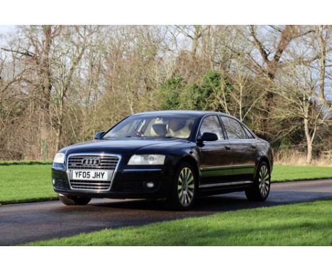
Registration No: YF05 JHY Chassis No: WAUZZZ4E05N016987 MOT: February 2026Warranted 66,000 miles from newJust four former keepers and offered from a significant private collectionRare and desirable 6.0 W12 engine variant producing 444hpAccompanied by very good service history with several from Audi main agentsThe W12 Quattro was the range-topping variant of the full-size luxury A8 saloon, with the second generation offering a W12 option (as the first had), which launched in 2005. The configuration allowed Audi to build a 12-cylinder saloon with all-wheel drive, with conventional V12 only able to facilitate rear-wheel drive configuration. Audi re-styled the A8 in 2005, giving all variants a taller, wider trapezoidal single-frame grille, with the W12 also being the first model was to be offered with LED running lights. The naturally aspirated 6.0-litre W12 delivers around 444bhp via a six-speed Tiptronic automatic transmission with paddle shift, with the W12’s maximum 428 lb ft of torque and performance figures of 5.1-second 0-62mph time, and an electronically limited 155mph top speed.Manufactured in 2005, ‘YF05 JHY’ was supplied new to its first owner on the 10th of June that year by Alexander Audi of Huddersfield. Finished in Brilliant Black paintwork, this is complemented by Cream leather interior upholstery, with a brushed aluminium dashboard and the optional Burr Walnut veneer trim. The factory specification includes Xenon headlights, front and rear parking sensors, switchable sports mode, electrically adjustable heated and cooled seats, and a Bose surround sound system. The W12 was further optioned new with electric, memory and auto-dimming mirrors, leather trimmed steering wheel, forged alloys, electric front memory comfort seats, laminated glass throughout, rear screen sun visor, and keyless entry. Offered now having covered a very modest 66,000 miles from new, the A8 has just four former keepers.Benefitting from four new tyres in 2021, new front brake pads in 2022, and a new battery early last year, the Audi is entered from a significant private collection. Supplied new two sets of keys and a history file, the documentation includes the book pack in the wallet (including the owner’s manual, operation instructions, service book, and DVD road map), a collection of invoices, MOT records, twelve month MOT, and a current V5C document. Between the service book and invoices, the A8 has a very good service history with eight services completed and the most recent having been completed at 63,649 miles. Coming to market with the original tool kit and warning triangle and two sets of keys, ‘YF05 JHY’ is a rare example of the range-topping W12 engine A8 with very modest mileage! For more information, please contact: Paul Cheetham paul.cheetham@handh.co.uk 07538 667452
Lot 38
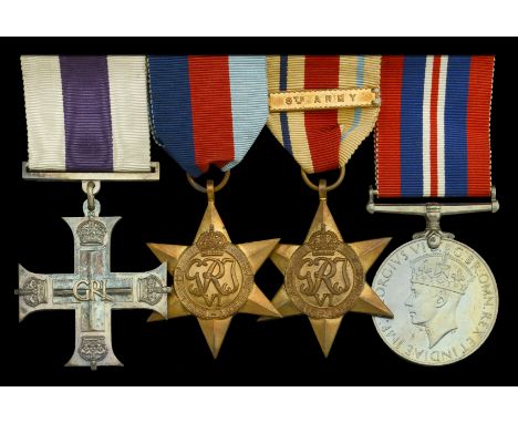
A Second War ‘Battle of Alamein’ M.C. group of four attributed to Lieutenant A. T. Almond, 46th (The Liverpool Welsh) Battalion, Royal Tank Regiment, who was killed in action on 28 October 1942 Military Cross, G.VI.R. reverse officially dated 1942, with Royal Mint case of issue; 1939-45 Star; Africa Star, 1 clasp, 8th Army; War Medal 1939-45; together with the named Army Council enclosure, extremely fine (4) £1,000-£1,400 --- M.C. London Gazette 5 November 1942: ‘In recognition of gallant and distinguished services in the Middle East.’ The original Recommendation, for an Immediate M.C., states: ‘During the Battle of Alamein, at about 0900 hrs on 4 September 1942, Second Lieutenant Almond’s troop was ordered forward on to an exposed position subject to a lot of enemy artillery fire. Second Lieutenant Almond’s tank receives a direct hit from a large calibre gun. The tank, which was moving at about 10 m.p.h., caught fire and ammunition exploded. Second Lieutenant Almond and his gunner climbed out on to the turret of the tank but did not leave the rank until they had extricated the driver. Second Lieutenant Almond, although ordered to evacuate his crew, returned on another tank and managed to put out the fire sufficiently to get into the driver’s seat. He then started the engine and, although burnt himself, managed to tow out another tank which had been hit. He then drove his tank back, collected his crew, and returned into action after getting the tank into fighting trim. In spite of his burns and a temporarily blinded eye, he remained in action for another 10 hors under almost continuous shell fire. The determination, bravery, and coolness under fire which this officer showed proved a fine example to the remainder of his troop and the fact that they remained in their position materially assisted the success of the action on this front.’ Arthur Thomas Almond was commissioned Second Lieutenant in the Royal Rank Regiment from 102nd O.C.T.U. on 28 December 1940, and served with the 46th (The Liverpool Welsh) Battalion during the Second World War in North Africa, using Valentine tanks. Awarded the Military Cross for his gallantry during the Battle of Alamein, he was killed in action on 28 October 1942, on which date the Battalion was in support of the 26th Australian Brigade. ‘Valentine in North Africa’ gives the following account: ‘El Alamein, 46th RTR by now were also working with the Australians, and during the main Australian thrust on the night of October 28/29 were to attack with 2/23rd Battalion and secure the road. Unfortunately, things began to go wrong from the start. The final briefing was held very late, and Colonel Clarke returned without sufficient time to give his Squadron Leaders anything more than the barest details. The attack was to get under way almost immediately, and would be delivered from a start-line which had been chosen from the map, and which had not been reconnoitred. Some of the infantry would ride on the tanks, and others in carriers. The start-line was in fact, in the middle of a minefield, and on the way to it the regiments were subjected to heavy fire which caused the infantry to drop off. Several tanks missed the minefield gaps and became casualties. The situation became extremely confused, and the enemy fire rose to a crescendo. In the light of three or four burning Valentines the anti-tank gunners were able to pick off their victims from three sides at ranges up to 1,000 yards. The attack broke down into un-coordinated assaults which took a heavy toll of both tanks and infantry. Colonel Clarke and his Intelligence Officer were badly wounded by a mortar shell, and the Regiment was taken over by Major Offord. After a night of savage fighting, Colonel Evans of 2/23rd finally ordered his battalion to dig in at 04.00, 1,000 yards in advance of the original start line, The 2/23rd had lost 29 killed, 172 wounded and 6 missing. The 46th RTR had lost all but eight of their tanks and had a high percentage of their crews killed or wounded, including all the Squadron Commanders. The casualties sustained by the 46th and 2/23rd Battalion had not been in vain. After the battle, Rommel recorded that the British tanks and infantry had succeeded in blowing a gap in his line, cutting off the 2nd Bn 125 Panzer Grenadier Regiment and a Battalion of XIth Bansagliari, who remained in Thompson’s Post, almost surrounded by their assailants, resisting all attempts to dislodge them with a ferocious determination. In addition, the 125th Regiment’s 3rd Battalion had virtually ceased to exist by next morning, the battle having raged with tremendous fury for six hours.’ Almond is buried in El Alamein War Cemetery, Egypt. Sold with a fine portrait photograph of the recipient; rank pips; Royal Tank Regiment cap badge; a miniature M.C., a leather bound Bible, the inside inscribed ‘A. T. Almond, R.T.R.’; and a copy of ‘The White Company’, by Sir Arthur Conan Doyle, with Bishop’s Stortford College Prize label affixed on the inside front cover, inscribed ‘Summer Term 1927, Form IA. Prize awarded to A. T. Almond’.
-
3951 item(s)/page