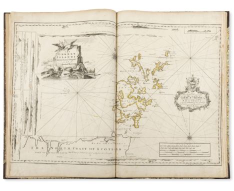
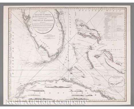
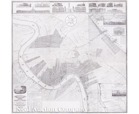
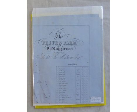
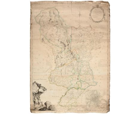
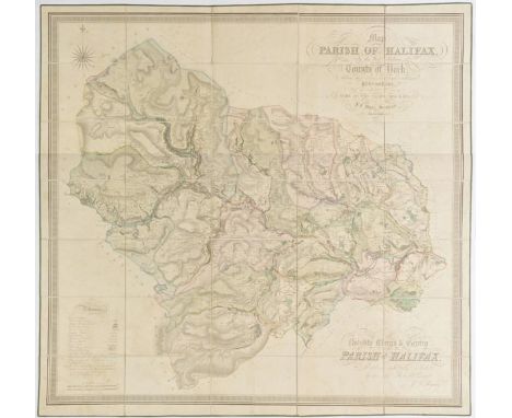
Charles F. Zimpel (Prussian/American, 1801-1879), "Topographical Map of New Orleans and its Vicinity, Embracing a distance of twelve miles up and eight and three quarter miles down the Mississippi River and Part of Lake Pontchartrain, representing all Public Improvements existing and projected and important Establishments, accompanied by A Statistical Table, containing the most accurate Illustrations; prefaced by A Splendid View of New Orleans, & Compiled from actual surveys and the best authorities, by Chas. F. Ximpel, Deputy City Surveyor of New Orleans, Chief Engineer of the New Orleans & Carrollton Rail Road Company and late Engineer in the Prussian Service, Scale six inches to the mile, New Orleans March 1834", lithograph, on six sheets, original folio, vignettes showing: Orleans Cotton Press Co., City Hotel, Levee Steam Cotton Press, City Hall (Cabildo), St. Louis Cathedral, Presbytere, Bank of the Canal and Banking Co., City House and Market of the City of Lafayette, Bank of New Orleans, Union Bank, American Theater, Sugar Refinery, Charity Hospital, State House, "Defeat of the British Army...", "Plan of the Banks of the Mississippi and Adjacent Country...", and "Mouth of the Mississippi at the South West Pass", six sheets (combined) 63 in. x 64 in. Note: Zimpel, Charles F. (Karl Frederick Zimpel) and the subject map are best summarized in Ellen Merrill’s Germans of Louisiana. Pelican Publishing Company, Inc. 2005:
“Zimpel was a young Prussian aristocrat who soon established a lucrative career in the city as a surveyor, engineer, and architect. His tastes were mainly classical, in keeping with the style in vogue in both Europe and America. He was highly successful in those areas in which he was trained and, for a short time, became deputy surveyor and chief engineer for the city. In 1833 he laid out and developed the City of Carrollton. Perhaps his most important achievement was the detailed map of New Orleans he produced in 1834. Dissatisfied with the quality produced by the lithographers in New Orleans, he sent his original drawing back to Germany. On the return trip the lithographic stone and reproductions were lost at sea, making the Zimpel map a collector’s item. As chief engineer of the New Orleans and Carrollton Railway, which ran from Canal Street to Carrollton Avenue along Nayades Street (now St. Charles Avenue), he got involved in land speculation. Having little experience in this area, he soon fell into debt and fled the city. After only seven years of working in New Orleans, he returned to his native Prussia.”
Zimpel also designed and oversaw construction of several important buildings in New Orleans during his tenure here, three of which are shown in vignettes above his map: the Bank of New Orleans, City Hotel, and the Orleans Cotton Press.
Only six copies of the Zimpel map have been located, five of which are housed in institutional collections.

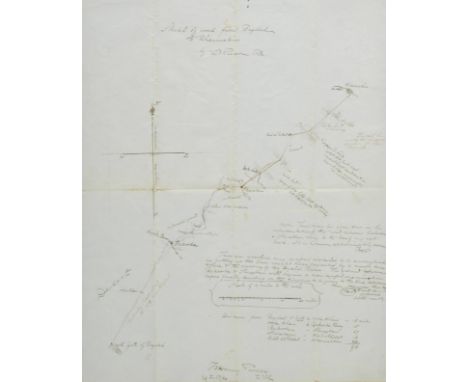
![17th Century Manuscript Estate MapCo. Tipperary: Hussey (Thomas) Surveyor, A Map of Ballingarry [Co. Tipperary], [sewing] the](https://cdn.globalauctionplatform.com/929564a4-7935-4296-a743-a7f20114bed4/9a1be7c2-4409-4928-e6f6-fbf5356de967/468x382.jpg)
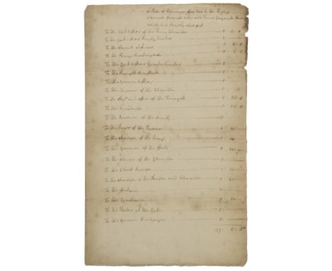
![Antrim.- A Survey and Valuation of one Estate of the Right Honble Alex.r [MacDonnell] Earl of Antrim made in the year 1734 by](https://cdn.globalauctionplatform.com/8766109f-1deb-4a16-a9ea-a7e0012ad58f/5f4351ee-267f-4fb6-eb17-8f99a4f9f812/468x382.jpg)
![Ogilby (John). The Roads from York to Whitby and Scarborough in Yorkshire, [1698], hand coloured engraved strip road map, dec](https://cdn.globalauctionplatform.com/602f3499-4c56-45fa-acbd-a7a900c85218/5f14ca05-ac5a-4247-b2ea-4aa4863e3e14/468x382.jpg)
![London.- Regent's Park.- House of Commons. First [-Fifth] Report of the Commissioners of His Majesty's Woods, Forests, and La](https://cdn.globalauctionplatform.com/dee7acb7-0eba-4924-bdfc-a79000f74b48/c0cd4251-ec24-4e0a-b6a5-7454f04713ac/468x382.jpg)
![Baker (Robert, Surveyor) [Map of Antigua] Antigue, Levee par Robert Baker, Arpenteur General de l'Isle. 1779, Paris, hand-col](https://cdn.globalauctionplatform.com/135cbed6-2ea5-4f55-bfb2-a73d00f710c4/c4212b1a-673e-4e11-ff3e-3b2082ffd41c/468x382.jpg)
![[Norden, John]. The Surveiors Dialogue, Very Profitable for all men to peruse, but especially for all Gentlemen, or any other](https://cdn.globalauctionplatform.com/6f06c57b-9702-4210-a2e3-a7400109952d/8e3164b6-ba53-4b17-d6e4-704bf24ea2d8/468x382.jpg)
![[Little, Otis]. The State of Trade in the Northern Colonies Considered; with an Account of their Produce, and a particular De](https://cdn.globalauctionplatform.com/6f06c57b-9702-4210-a2e3-a7400109952d/0475a218-09c4-46ad-edf2-18468cae2b29/468x382.jpg)
![[Carter, John]. The Builder's Magazine: or, A Universal Dictionary for Architects, Carpenters, Masons, Bricklayers, &c. as we](https://cdn.globalauctionplatform.com/6f06c57b-9702-4210-a2e3-a7400109952d/9c1e3247-f96a-442a-a43c-13fe841f21df/468x382.jpg)
![Surveying & Sun Dials.- Practical Surveying by The Chain and Square [&] A new method of Constructing Sun Dials for any given](https://cdn.globalauctionplatform.com/dfd0ae87-7b72-44bd-9d38-a72a00a83cab/00c479ad-f5f3-42b9-9073-4f5d6a5376fa/468x382.jpg)